You are here: Home > Network List > TA - USArray Transportable Network (new EarthScope stations) Stations List
> Station I64A Boothbay, ME, USA > Earthquake Result Viewer
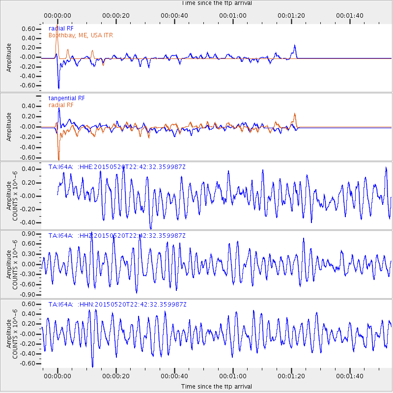
I64A Boothbay, ME, USA - Earthquake Result Viewer
*The percent match for this event was below the threshold and hence no stack was calculated.
| Earthquake location: |
Peru-Ecuador Border Region |
| Earthquake latitude/longitude: |
-3.1/-77.7 |
| Earthquake time(UTC): |
2015/05/20 (140) 22:34:30 GMT |
| Earthquake Depth: |
20 km |
| Earthquake Magnitude: |
5.1 mb, 5.1 mb |
| Earthquake Catalog/Contributor: |
ISC/ISC |
|
| Network: |
TA USArray Transportable Network (new EarthScope stations) |
| Station: |
I64A Boothbay, ME, USA |
| Lat/Lon: |
43.92 N/69.63 W |
| Elevation: |
17 m |
|
| Distance: |
47.4 deg |
| Az: |
7.912 deg |
| Baz: |
190.965 deg |
| Ray Param: |
$rayparam |
*The percent match for this event was below the threshold and hence was not used in the summary stack. |
|
| Radial Match: |
73.40149 % |
| Radial Bump: |
400 |
| Transverse Match: |
53.117477 % |
| Transverse Bump: |
400 |
| SOD ConfigId: |
7422571 |
| Insert Time: |
2019-04-18 23:45:48.050 +0000 |
| GWidth: |
2.5 |
| Max Bumps: |
400 |
| Tol: |
0.001 |
|
Signal To Noise
| Channel | StoN | STA | LTA |
| TA:I64A: :HHZ:20150520T22:42:32.359987Z | 0.8765112 | 2.4292913E-7 | 2.7715464E-7 |
| TA:I64A: :HHN:20150520T22:42:32.359987Z | 0.9213291 | 1.7562607E-7 | 1.9062252E-7 |
| TA:I64A: :HHE:20150520T22:42:32.359987Z | 1.5046303 | 2.737576E-7 | 1.8194342E-7 |
| Arrivals |
| Ps | |
| PpPs | |
| PsPs/PpSs | |


