You are here: Home > Network List > TA - USArray Transportable Network (new EarthScope stations) Stations List
> Station MDND Maddock, ND, USA > Earthquake Result Viewer
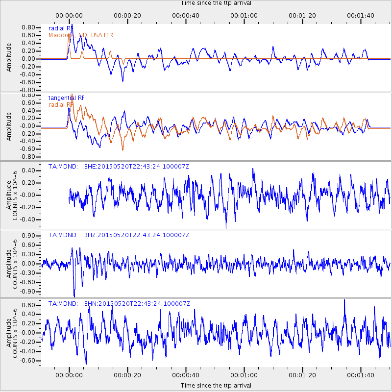
MDND Maddock, ND, USA - Earthquake Result Viewer
*The percent match for this event was below the threshold and hence no stack was calculated.
| Earthquake location: |
Peru-Ecuador Border Region |
| Earthquake latitude/longitude: |
-3.1/-77.7 |
| Earthquake time(UTC): |
2015/05/20 (140) 22:34:30 GMT |
| Earthquake Depth: |
20 km |
| Earthquake Magnitude: |
5.1 mb, 5.1 mb |
| Earthquake Catalog/Contributor: |
ISC/ISC |
|
| Network: |
TA USArray Transportable Network (new EarthScope stations) |
| Station: |
MDND Maddock, ND, USA |
| Lat/Lon: |
47.85 N/99.60 W |
| Elevation: |
479 m |
|
| Distance: |
54.3 deg |
| Az: |
341.96 deg |
| Baz: |
152.672 deg |
| Ray Param: |
$rayparam |
*The percent match for this event was below the threshold and hence was not used in the summary stack. |
|
| Radial Match: |
59.34112 % |
| Radial Bump: |
400 |
| Transverse Match: |
60.42362 % |
| Transverse Bump: |
400 |
| SOD ConfigId: |
7422571 |
| Insert Time: |
2019-04-18 23:46:01.355 +0000 |
| GWidth: |
2.5 |
| Max Bumps: |
400 |
| Tol: |
0.001 |
|
Signal To Noise
| Channel | StoN | STA | LTA |
| TA:MDND: :BHZ:20150520T22:43:24.100007Z | 5.1435866 | 4.028935E-7 | 7.8329286E-8 |
| TA:MDND: :BHN:20150520T22:43:24.100007Z | 1.365442 | 2.3633288E-7 | 1.730816E-7 |
| TA:MDND: :BHE:20150520T22:43:24.100007Z | 1.0765178 | 1.4038031E-7 | 1.3040221E-7 |
| Arrivals |
| Ps | |
| PpPs | |
| PsPs/PpSs | |


