You are here: Home > Network List > TA - USArray Transportable Network (new EarthScope stations) Stations List
> Station O48A Farmland, IN, USA > Earthquake Result Viewer
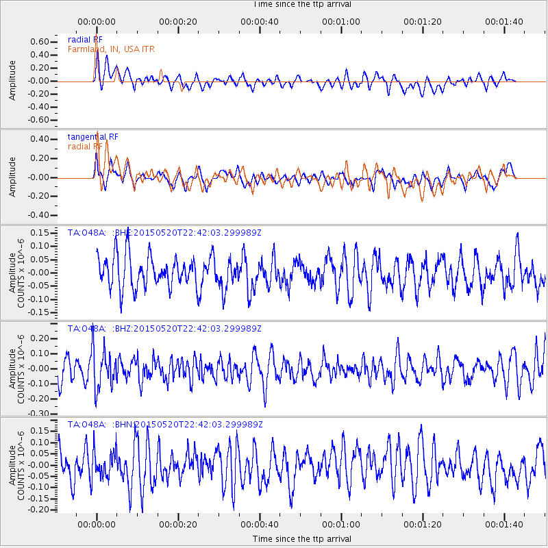
O48A Farmland, IN, USA - Earthquake Result Viewer
*The percent match for this event was below the threshold and hence no stack was calculated.
| Earthquake location: |
Peru-Ecuador Border Region |
| Earthquake latitude/longitude: |
-3.1/-77.7 |
| Earthquake time(UTC): |
2015/05/20 (140) 22:34:30 GMT |
| Earthquake Depth: |
20 km |
| Earthquake Magnitude: |
5.1 mb, 5.1 mb |
| Earthquake Catalog/Contributor: |
ISC/ISC |
|
| Network: |
TA USArray Transportable Network (new EarthScope stations) |
| Station: |
O48A Farmland, IN, USA |
| Lat/Lon: |
40.26 N/85.16 W |
| Elevation: |
300 m |
|
| Distance: |
43.7 deg |
| Az: |
351.727 deg |
| Baz: |
169.179 deg |
| Ray Param: |
$rayparam |
*The percent match for this event was below the threshold and hence was not used in the summary stack. |
|
| Radial Match: |
52.29472 % |
| Radial Bump: |
400 |
| Transverse Match: |
56.9948 % |
| Transverse Bump: |
400 |
| SOD ConfigId: |
7422571 |
| Insert Time: |
2019-04-18 23:46:05.593 +0000 |
| GWidth: |
2.5 |
| Max Bumps: |
400 |
| Tol: |
0.001 |
|
Signal To Noise
| Channel | StoN | STA | LTA |
| TA:O48A: :BHZ:20150520T22:42:03.299989Z | 1.6490654 | 1.2975477E-7 | 7.868382E-8 |
| TA:O48A: :BHN:20150520T22:42:03.299989Z | 0.74835265 | 5.6853686E-8 | 7.597179E-8 |
| TA:O48A: :BHE:20150520T22:42:03.299989Z | 0.9011451 | 5.282645E-8 | 5.8621467E-8 |
| Arrivals |
| Ps | |
| PpPs | |
| PsPs/PpSs | |


