You are here: Home > Network List > AZ - ANZA Regional Network Stations List
> Station SMER AZ.SMER > Earthquake Result Viewer
SMER AZ.SMER - Earthquake Result Viewer
*The percent match for this event was below the threshold and hence no stack was calculated.
| Earthquake location: |
Santa Cruz Islands Region |
| Earthquake latitude/longitude: |
-10.9/164.2 |
| Earthquake time(UTC): |
2015/05/20 (140) 22:48:53 GMT |
| Earthquake Depth: |
12 km |
| Earthquake Magnitude: |
6.8 MWW, 6.7 MWB, 6.8 MWC, 6.9 MI |
| Earthquake Catalog/Contributor: |
NEIC PDE/NEIC COMCAT |
|
| Network: |
AZ ANZA Regional Network |
| Station: |
SMER AZ.SMER |
| Lat/Lon: |
33.46 N/117.17 W |
| Elevation: |
355 m |
|
| Distance: |
86.7 deg |
| Az: |
55.195 deg |
| Baz: |
254.738 deg |
| Ray Param: |
$rayparam |
*The percent match for this event was below the threshold and hence was not used in the summary stack. |
|
| Radial Match: |
77.274 % |
| Radial Bump: |
400 |
| Transverse Match: |
43.87039 % |
| Transverse Bump: |
400 |
| SOD ConfigId: |
7422571 |
| Insert Time: |
2019-04-18 23:50:24.175 +0000 |
| GWidth: |
2.5 |
| Max Bumps: |
400 |
| Tol: |
0.001 |
|
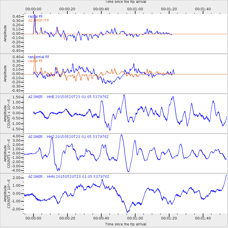
Signal To Noise
| Channel | StoN | STA | LTA |
| AZ:SMER: :HHZ:20150520T23:01:05.537976Z | 6.0446715 | 6.4531116E-7 | 1.0675703E-7 |
| AZ:SMER: :HHN:20150520T23:01:05.537976Z | 1.8456652 | 8.148832E-7 | 4.4151193E-7 |
| AZ:SMER: :HHE:20150520T23:01:05.537976Z | 1.0174322 | 1.9876694E-7 | 1.9536137E-7 |
| Arrivals |
| Ps | |
| PpPs | |
| PsPs/PpSs | |


