PMG Port Moresby, New Guinea - Earthquake Result Viewer
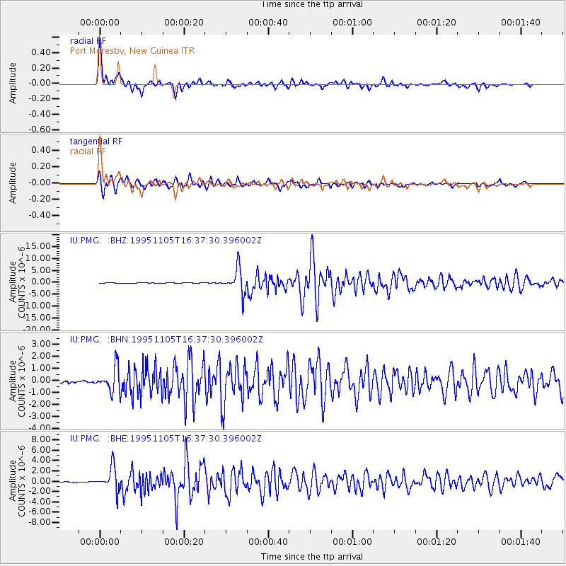
Earthquake location: Southern Sumatra, Indonesia
Earthquake latitude/longitude: -4.9/103.2
Earthquake time(UTC): 1995/11/05 (309) 16:30:00 GMT
Earthquake Depth: 58 km
Earthquake Magnitude: 6.3 MB, 6.1 MS, 5.9 UNKNOWN, 6.3 MW
Earthquake Catalog/Contributor: WHDF/NEIC
Network: IU Global Seismograph Network (GSN - IRIS/USGS)
Station: PMG Port Moresby, New Guinea
Lat/Lon: 9.41 S/147.15 E
Elevation: 67 m
Distance: 43.8 deg
Az: 98.402 deg
Baz: 272.672 deg
Ray Param: 0.07215768
Estimated Moho Depth: 34.5 km
Estimated Crust Vp/Vs: 1.66
Assumed Crust Vp: 6.122 km/s
Estimated Crust Vs: 3.682 km/s
Estimated Crust Poisson's Ratio: 0.22
Radial Match: 95.76837 %
Radial Bump: 400
Transverse Match: 91.70964 %
Transverse Bump: 400
SOD ConfigId: 6273
Insert Time: 2010-03-02 15:12:54.324 +0000
GWidth: 2.5
Max Bumps: 400
Tol: 0.001

Signal To Noise

ChannelStoNSTALTA
IU:PMG: :BHN:19951105T16:37:30.396002Z16.0040531.0127616E-66.328157E-8
IU:PMG: :BHE:19951105T16:37:30.396002Z31.8640292.3306131E-67.3142445E-8
IU:PMG: :BHZ:19951105T16:37:30.396002Z64.217785.4505444E-68.487594E-8
Arrivals
Ps4.0 SECOND
PpPs14 SECOND
PsPs/PpSs18 SECOND