
PMG Port Moresby, New Guinea - Earthquake Result Viewer
| ||||||||||||||||||
| ||||||||||||||||||
| ||||||||||||||||||
|
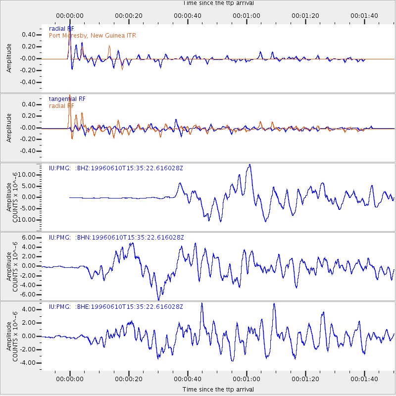
Signal To Noise
| Channel | StoN | STA | LTA |
| IU:PMG: :BHN:19960610T15:35:22.616028Z | 1.7014369 | 1.430183E-7 | 8.405736E-8 |
| IU:PMG: :BHE:19960610T15:35:22.616028Z | 1.888046 | 1.6068682E-7 | 8.510747E-8 |
| IU:PMG: :BHZ:19960610T15:35:22.616028Z | 2.9789655 | 3.1977294E-7 | 1.0734362E-7 |
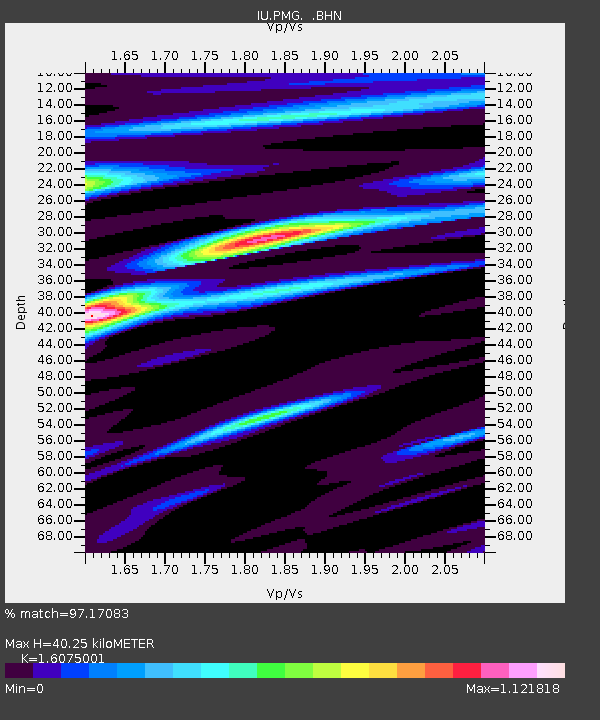
| Arrivals | |
| Ps | 4.2 SECOND |
| PpPs | 16 SECOND |
| PsPs/PpSs | 21 SECOND |

