PMG Port Moresby, New Guinea - Earthquake Result Viewer
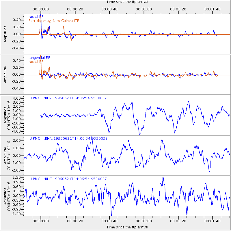
Earthquake location: Off East Coast Of Kamchatka
Earthquake latitude/longitude: 51.6/159.1
Earthquake time(UTC): 1996/06/21 (173) 13:57:10 GMT
Earthquake Depth: 20 km
Earthquake Magnitude: 6.0 MB, 6.6 MS, 7.0 UNKNOWN, 6.5 MS
Earthquake Catalog/Contributor: WHDF/NEIC
Network: IU Global Seismograph Network (GSN - IRIS/USGS)
Station: PMG Port Moresby, New Guinea
Lat/Lon: 9.41 S/147.15 E
Elevation: 67 m
Distance: 61.6 deg
Az: 193.447 deg
Baz: 8.459 deg
Ray Param: 0.060747046
Estimated Moho Depth: 28.75 km
Estimated Crust Vp/Vs: 2.05
Assumed Crust Vp: 6.122 km/s
Estimated Crust Vs: 2.994 km/s
Estimated Crust Poisson's Ratio: 0.34
Radial Match: 94.405136 %
Radial Bump: 391
Transverse Match: 70.68761 %
Transverse Bump: 400
SOD ConfigId: 6273
Insert Time: 2010-03-02 15:13:41.862 +0000
GWidth: 2.5
Max Bumps: 400
Tol: 0.001

Signal To Noise

ChannelStoNSTALTA
IU:PMG: :BHN:19960621T14:06:54.953003Z1.69832683.049554E-71.7956226E-7
IU:PMG: :BHE:19960621T14:06:54.953003Z0.57658261.3537854E-72.3479471E-7
IU:PMG: :BHZ:19960621T14:06:54.953003Z3.51398357.6945E-72.1896801E-7
Arrivals
Ps5.1 SECOND
PpPs14 SECOND
PsPs/PpSs19 SECOND