HEBO Mt. Hebo, OR CREST BB SMO - Earthquake Result Viewer
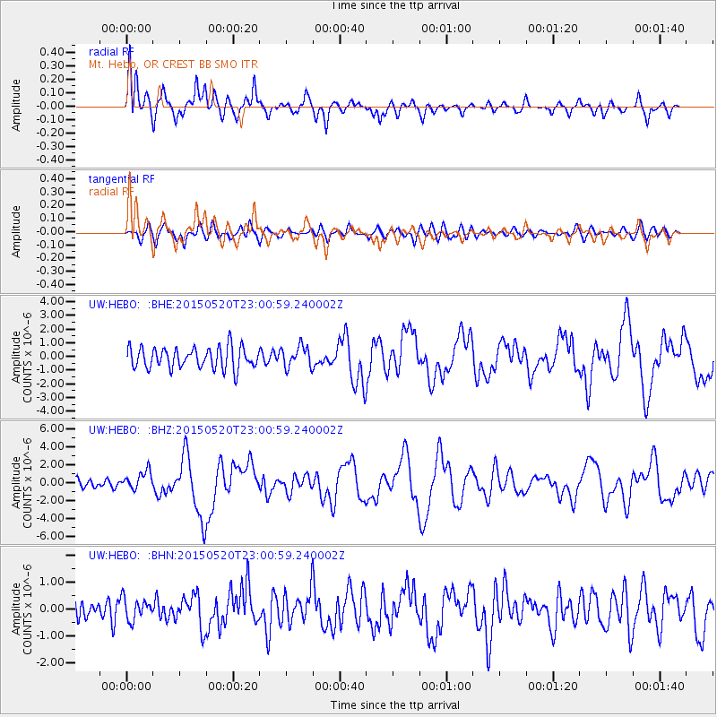
Earthquake location: Santa Cruz Islands Region
Earthquake latitude/longitude: -10.9/164.2
Earthquake time(UTC): 2015/05/20 (140) 22:48:53 GMT
Earthquake Depth: 12 km
Earthquake Magnitude: 6.8 MWW, 6.7 MWB, 6.8 MWC, 6.9 MI
Earthquake Catalog/Contributor: NEIC PDE/NEIC COMCAT
Network: UW Pacific Northwest Regional Seismic Network
Station: HEBO Mt. Hebo, OR CREST BB SMO
Lat/Lon: 45.21 N/123.76 W
Elevation: 875 m
Distance: 85.4 deg
Az: 42.438 deg
Baz: 249.665 deg
Ray Param: 0.044812474
Estimated Moho Depth: 36.5 km
Estimated Crust Vp/Vs: 1.60
Assumed Crust Vp: 6.566 km/s
Estimated Crust Vs: 4.104 km/s
Estimated Crust Poisson's Ratio: 0.18
Radial Match: 84.59052 %
Radial Bump: 400
Transverse Match: 68.19907 %
Transverse Bump: 400
SOD ConfigId: 7422571
Insert Time: 2019-04-18 23:55:12.217 +0000
GWidth: 2.5
Max Bumps: 400
Tol: 0.001

Signal To Noise

ChannelStoNSTALTA
UW:HEBO: :BHZ:20150520T23:00:59.240002Z2.08254461.0372806E-64.980833E-7
UW:HEBO: :BHN:20150520T23:00:59.240002Z0.97123443.9952513E-74.1135812E-7
UW:HEBO: :BHE:20150520T23:00:59.240002Z0.97716797.5296475E-77.705582E-7
Arrivals
Ps3.4 SECOND
PpPs14 SECOND
PsPs/PpSs17 SECOND