
HOOD Mt Hood Meadows, OR CREST BB SMO - Earthquake Result Viewer
| ||||||||||||||||||
| ||||||||||||||||||
| ||||||||||||||||||
|
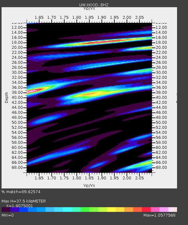
Signal To Noise
| Channel | StoN | STA | LTA |
| UW:HOOD: :BHZ:20150520T23:01:06.300Z | 8.369037 | 7.306985E-7 | 8.730976E-8 |
| UW:HOOD: :BHN:20150520T23:01:06.300Z | 2.056668 | 1.7961574E-7 | 8.733337E-8 |
| UW:HOOD: :BHE:20150520T23:01:06.300Z | 1.5650599 | 3.0552184E-7 | 1.9521416E-7 |
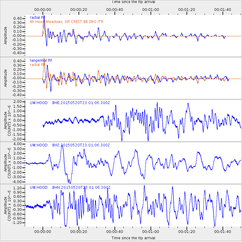
| Arrivals | |
| Ps | 3.5 SECOND |
| PpPs | 14 SECOND |
| PsPs/PpSs | 18 SECOND |

