LON Longmire CREST broad-band - Earthquake Result Viewer
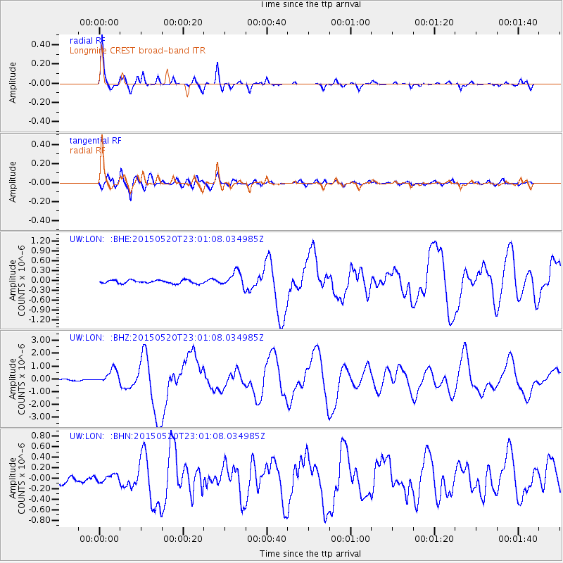
Earthquake location: Santa Cruz Islands Region
Earthquake latitude/longitude: -10.9/164.2
Earthquake time(UTC): 2015/05/20 (140) 22:48:53 GMT
Earthquake Depth: 12 km
Earthquake Magnitude: 6.8 MWW, 6.7 MWB, 6.8 MWC, 6.9 MI
Earthquake Catalog/Contributor: NEIC PDE/NEIC COMCAT
Network: UW Pacific Northwest Regional Seismic Network
Station: LON Longmire CREST broad-band
Lat/Lon: 46.75 N/121.81 W
Elevation: 853 m
Distance: 87.2 deg
Az: 41.445 deg
Baz: 250.996 deg
Ray Param: 0.043519765
Estimated Moho Depth: 67.25 km
Estimated Crust Vp/Vs: 1.75
Assumed Crust Vp: 6.597 km/s
Estimated Crust Vs: 3.77 km/s
Estimated Crust Poisson's Ratio: 0.26
Radial Match: 94.829315 %
Radial Bump: 325
Transverse Match: 88.144264 %
Transverse Bump: 400
SOD ConfigId: 7422571
Insert Time: 2019-04-18 23:55:17.749 +0000
GWidth: 2.5
Max Bumps: 400
Tol: 0.001

Signal To Noise

ChannelStoNSTALTA
UW:LON: :BHZ:20150520T23:01:08.034985Z10.0833445.705789E-75.6586277E-8
UW:LON: :BHN:20150520T23:01:08.034985Z1.01564176.657443E-86.554913E-8
UW:LON: :BHE:20150520T23:01:08.034985Z4.46194932.181236E-74.888527E-8
Arrivals
Ps7.8 SECOND
PpPs27 SECOND
PsPs/PpSs35 SECOND