PMG Port Moresby, New Guinea - Earthquake Result Viewer
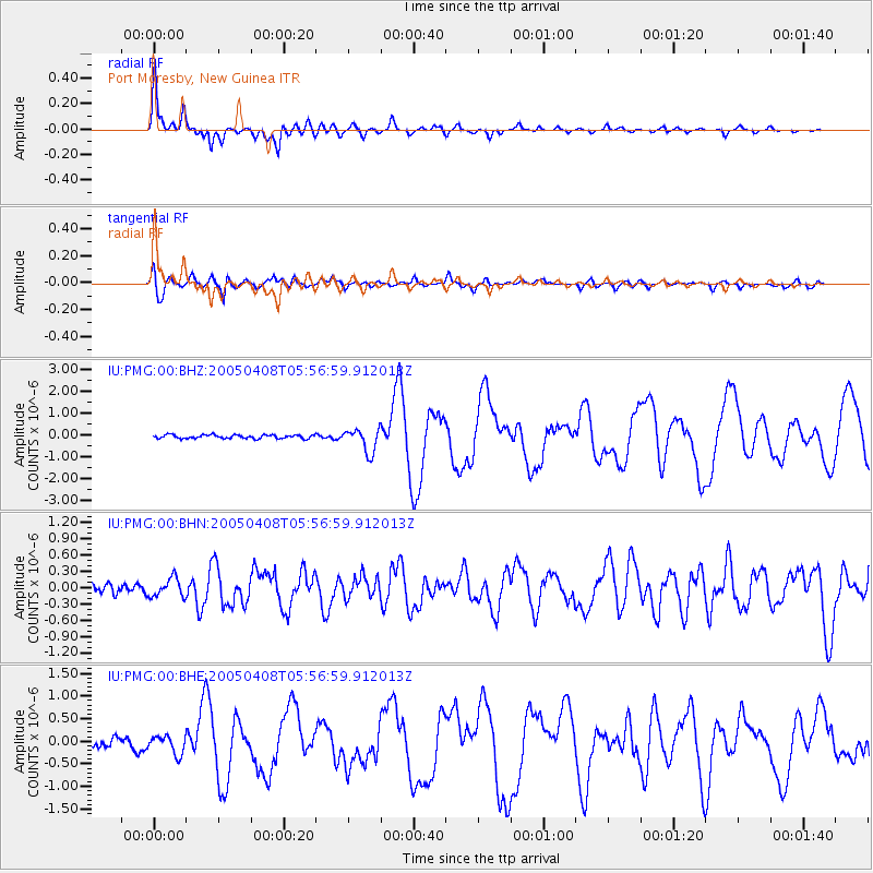
Earthquake location: Southwest Of Sumatra, Indonesia
Earthquake latitude/longitude: -0.2/97.7
Earthquake time(UTC): 2005/04/08 (098) 05:48:37 GMT
Earthquake Depth: 21 km
Earthquake Magnitude: 5.7 MB, 6.3 MS, 6.1 MW, 6.1 MW
Earthquake Catalog/Contributor: WHDF/NEIC
Network: IU Global Seismograph Network (GSN - IRIS/USGS)
Station: PMG Port Moresby, New Guinea
Lat/Lon: 9.41 S/147.15 E
Elevation: 67 m
Distance: 50.0 deg
Az: 102.053 deg
Baz: 277.647 deg
Ray Param: 0.06829897
Estimated Moho Depth: 32.75 km
Estimated Crust Vp/Vs: 1.85
Assumed Crust Vp: 6.122 km/s
Estimated Crust Vs: 3.318 km/s
Estimated Crust Poisson's Ratio: 0.29
Radial Match: 94.83487 %
Radial Bump: 348
Transverse Match: 85.56019 %
Transverse Bump: 400
SOD ConfigId: 2459
Insert Time: 2010-03-02 15:14:26.614 +0000
GWidth: 2.5
Max Bumps: 400
Tol: 0.001

Signal To Noise

ChannelStoNSTALTA
IU:PMG:00:BHN:20050408T05:56:59.912013Z1.27205351.7047472E-71.3401538E-7
IU:PMG:00:BHE:20050408T05:56:59.912013Z2.04723382.026387E-79.8981715E-8
IU:PMG:00:BHZ:20050408T05:56:59.912013Z6.39152435.417272E-78.4757126E-8
Arrivals
Ps4.8 SECOND
PpPs14 SECOND
PsPs/PpSs19 SECOND