PMG Port Moresby, New Guinea - Earthquake Result Viewer
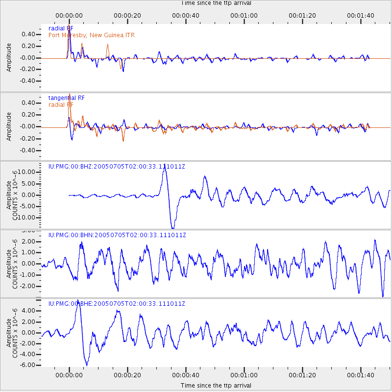
Earthquake location: Northern Sumatra, Indonesia
Earthquake latitude/longitude: 1.8/97.1
Earthquake time(UTC): 2005/07/05 (186) 01:52:02 GMT
Earthquake Depth: 21 km
Earthquake Magnitude: 6.2 MB, 6.8 MS, 6.7 MW, 6.6 MW
Earthquake Catalog/Contributor: WHDF/NEIC
Network: IU Global Seismograph Network (GSN - IRIS/USGS)
Station: PMG Port Moresby, New Guinea
Lat/Lon: 9.41 S/147.15 E
Elevation: 67 m
Distance: 51.1 deg
Az: 103.546 deg
Baz: 280.011 deg
Ray Param: 0.06759425
Estimated Moho Depth: 35.75 km
Estimated Crust Vp/Vs: 1.66
Assumed Crust Vp: 6.122 km/s
Estimated Crust Vs: 3.693 km/s
Estimated Crust Poisson's Ratio: 0.21
Radial Match: 93.128525 %
Radial Bump: 398
Transverse Match: 78.8225 %
Transverse Bump: 400
SOD ConfigId: 2475
Insert Time: 2010-03-02 15:14:33.155 +0000
GWidth: 2.5
Max Bumps: 400
Tol: 0.001

Signal To Noise

ChannelStoNSTALTA
IU:PMG:00:BHN:20050705T02:00:33.111011Z4.3890471.1032898E-62.5137345E-7
IU:PMG:00:BHE:20050705T02:00:33.111011Z8.7198213.0770764E-63.5288298E-7
IU:PMG:00:BHZ:20050705T02:00:33.111011Z16.0040256.5918534E-64.1188724E-7
Arrivals
Ps4.1 SECOND
PpPs15 SECOND
PsPs/PpSs19 SECOND