
PMG Port Moresby, New Guinea - Earthquake Result Viewer
| ||||||||||||||||||
| ||||||||||||||||||
| ||||||||||||||||||
|
Signal To Noise
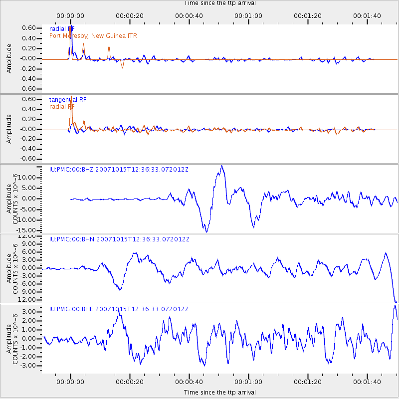
| Channel | StoN | STA | LTA |
| IU:PMG:00:BHN:20071015T12:36:33.072012Z | 2.5588896 | 5.184223E-7 | 2.0259661E-7 |
| IU:PMG:00:BHE:20071015T12:36:33.072012Z | 1.2392087 | 2.67292E-7 | 2.156957E-7 |
| IU:PMG:00:BHZ:20071015T12:36:33.072012Z | 4.6928287 | 1.0426862E-6 | 2.2218715E-7 |
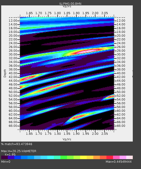
| Arrivals | |
| Ps | 4.6 SECOND |
| PpPs | 13 SECOND |
| PsPs/PpSs | 17 SECOND |

