
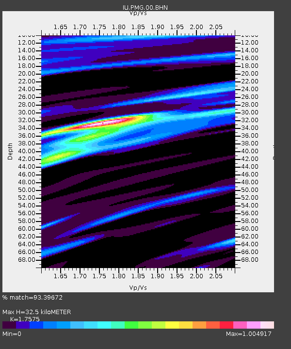
PMG Port Moresby, New Guinea - Earthquake Result Viewer
| ||||||||||||||||||
| ||||||||||||||||||
| ||||||||||||||||||
|
Signal To Noise
| Channel | StoN | STA | LTA |
| IU:PMG:00:BHN:20070118T15:35:05.38601Z | 1.3933598 | 1.244558E-7 | 8.932064E-8 |
| IU:PMG:00:BHE:20070118T15:35:05.38601Z | 5.986833 | 5.48141E-7 | 9.1557744E-8 |
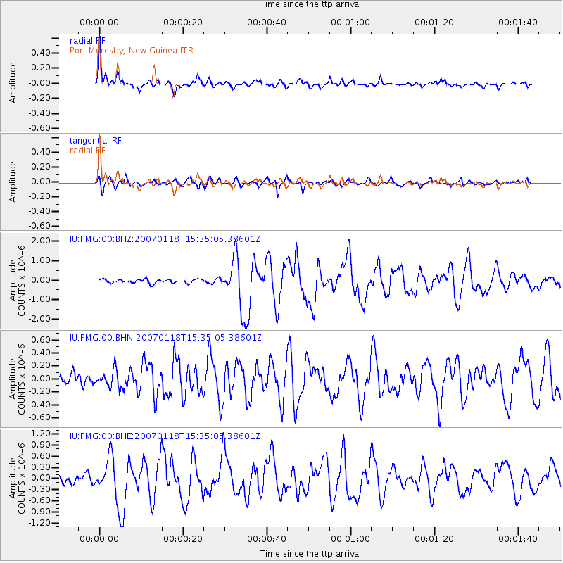
| IU:PMG:00:BHZ:20070118T15:35:05.38601Z | 13.501411 | 1.2647699E-6 | 9.367687E-8 |
| Arrivals | |
| Ps | 4.3 SECOND |
| PpPs | 14 SECOND |
| PsPs/PpSs | 18 SECOND |

