
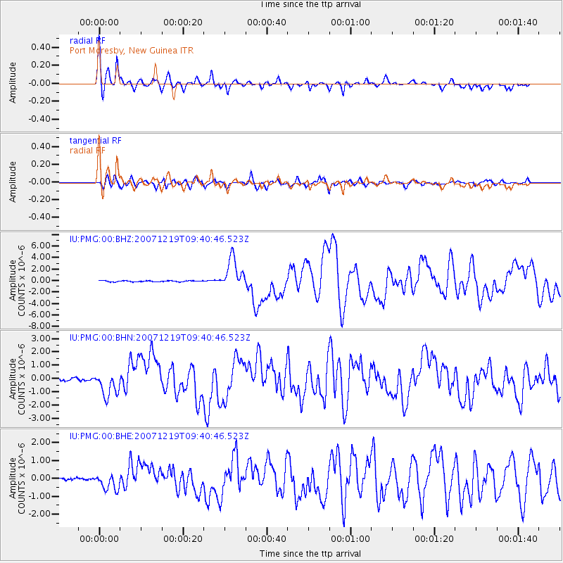
PMG Port Moresby, New Guinea - Earthquake Result Viewer
| ||||||||||||||||||
| ||||||||||||||||||
| ||||||||||||||||||
|
Signal To Noise
| Channel | StoN | STA | LTA |
| IU:PMG:00:BHN:20071219T09:40:46.523Z | 4.781681 | 8.673313E-7 | 1.8138627E-7 |
| IU:PMG:00:BHE:20071219T09:40:46.523Z | 5.0281696 | 4.4334575E-7 | 8.81724E-8 |
| IU:PMG:00:BHZ:20071219T09:40:46.523Z | 27.766422 | 2.689486E-6 | 9.686109E-8 |
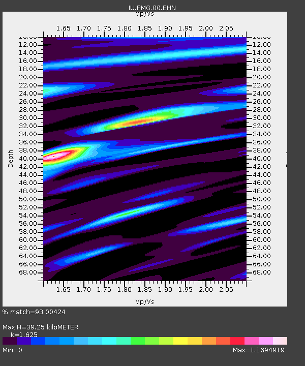
| Arrivals | |
| Ps | 4.2 SECOND |
| PpPs | 16 SECOND |
| PsPs/PpSs | 20 SECOND |

