PMG Port Moresby, New Guinea - Earthquake Result Viewer
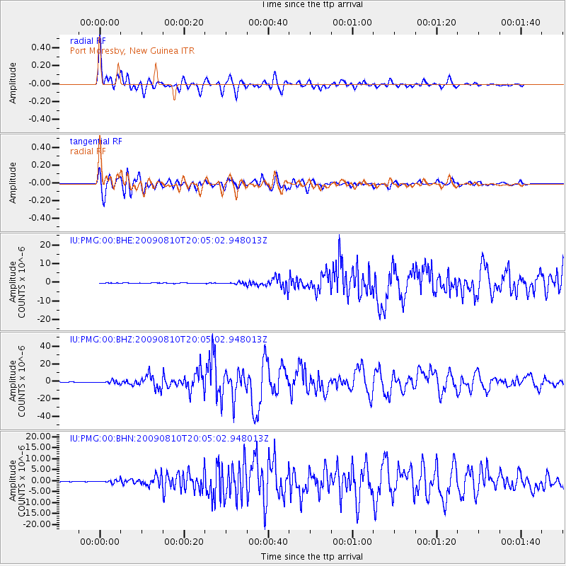
Earthquake location: Andaman Islands, India Region
Earthquake latitude/longitude: 14.1/92.9
Earthquake time(UTC): 2009/08/10 (222) 19:55:35 GMT
Earthquake Depth: 4.7 km
Earthquake Magnitude: 6.9 MB, 7.6 MS, 7.5 MW, 7.5 MW
Earthquake Catalog/Contributor: WHDF/NEIC
Network: IU Global Seismograph Network (GSN - IRIS/USGS)
Station: PMG Port Moresby, New Guinea
Lat/Lon: 9.40 S/147.16 E
Elevation: 90 m
Distance: 58.7 deg
Az: 110.343 deg
Baz: 292.783 deg
Ray Param: 0.06269648
Estimated Moho Depth: 63.0 km
Estimated Crust Vp/Vs: 1.62
Assumed Crust Vp: 6.122 km/s
Estimated Crust Vs: 3.767 km/s
Estimated Crust Poisson's Ratio: 0.20
Radial Match: 94.00693 %
Radial Bump: 400
Transverse Match: 91.18438 %
Transverse Bump: 400
SOD ConfigId: 2622
Insert Time: 2010-03-02 15:15:09.010 +0000
GWidth: 2.5
Max Bumps: 400
Tol: 0.001

Signal To Noise

ChannelStoNSTALTA
IU:PMG:00:BHZ:20090810T20:05:02.948013Z10.1185171.6891307E-61.6693461E-7
IU:PMG:00:BHN:20090810T20:05:02.948013Z6.218546.9184046E-71.1125447E-7
IU:PMG:00:BHE:20090810T20:05:02.948013Z3.61264254.766379E-71.3193608E-7
Arrivals
Ps6.7 SECOND
PpPs26 SECOND
PsPs/PpSs32 SECOND