
PMG Port Moresby, New Guinea - Earthquake Result Viewer
| ||||||||||||||||||
| ||||||||||||||||||
| ||||||||||||||||||
|
Signal To Noise
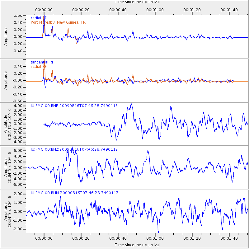
| Channel | StoN | STA | LTA |
| IU:PMG:00:BHZ:20090816T07:46:28.749011Z | 2.7137141 | 7.366001E-7 | 2.7143616E-7 |
| IU:PMG:00:BHN:20090816T07:46:28.749011Z | 1.3360577 | 3.156528E-7 | 2.3625688E-7 |
| IU:PMG:00:BHE:20090816T07:46:28.749011Z | 1.6243534 | 3.8360471E-7 | 2.361584E-7 |
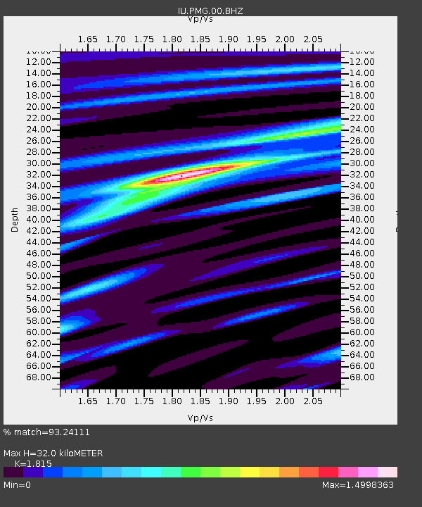
| Arrivals | |
| Ps | 4.5 SECOND |
| PpPs | 14 SECOND |
| PsPs/PpSs | 18 SECOND |

