You are here: Home > Network List > TA - USArray Transportable Network (new EarthScope stations) Stations List
> Station 121A Cookes Peak, Deming, NM, USA > Earthquake Result Viewer
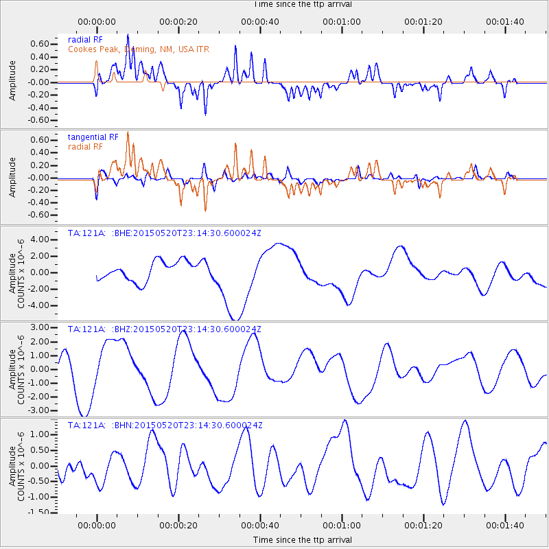
121A Cookes Peak, Deming, NM, USA - Earthquake Result Viewer
*The percent match for this event was below the threshold and hence no stack was calculated.
| Earthquake location: |
Solomon Islands |
| Earthquake latitude/longitude: |
-11.0/163.7 |
| Earthquake time(UTC): |
2015/05/20 (140) 23:01:44 GMT |
| Earthquake Depth: |
31 km |
| Earthquake Magnitude: |
5.1 mb, 5.0 mb |
| Earthquake Catalog/Contributor: |
ISC/ISC |
|
| Network: |
TA USArray Transportable Network (new EarthScope stations) |
| Station: |
121A Cookes Peak, Deming, NM, USA |
| Lat/Lon: |
32.53 N/107.79 W |
| Elevation: |
1652 m |
|
| Distance: |
94.6 deg |
| Az: |
57.901 deg |
| Baz: |
259.931 deg |
| Ray Param: |
$rayparam |
*The percent match for this event was below the threshold and hence was not used in the summary stack. |
|
| Radial Match: |
80.78432 % |
| Radial Bump: |
400 |
| Transverse Match: |
61.468876 % |
| Transverse Bump: |
400 |
| SOD ConfigId: |
7422571 |
| Insert Time: |
2019-04-19 00:00:55.745 +0000 |
| GWidth: |
2.5 |
| Max Bumps: |
400 |
| Tol: |
0.001 |
|
Signal To Noise
| Channel | StoN | STA | LTA |
| TA:121A: :BHZ:20150520T23:14:30.600024Z | 2.6583974 | 1.6889342E-6 | 6.353204E-7 |
| TA:121A: :BHN:20150520T23:14:30.600024Z | 1.1485004 | 4.968152E-7 | 4.3257725E-7 |
| TA:121A: :BHE:20150520T23:14:30.600024Z | 3.8576183 | 4.4478E-6 | 1.1529912E-6 |
| Arrivals |
| Ps | |
| PpPs | |
| PsPs/PpSs | |


