You are here: Home > Network List > TA - USArray Transportable Network (new EarthScope stations) Stations List
> Station H17A Grant Village (NPS), Yellowstone Nt. Park, WY, USA > Earthquake Result Viewer
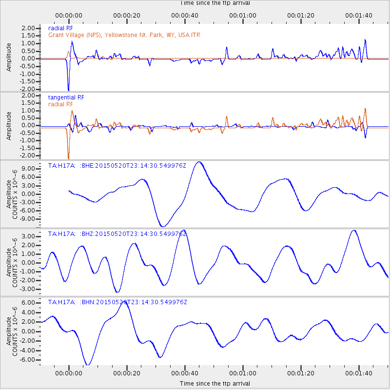
H17A Grant Village (NPS), Yellowstone Nt. Park, WY, USA - Earthquake Result Viewer
*The percent match for this event was below the threshold and hence no stack was calculated.
| Earthquake location: |
Solomon Islands |
| Earthquake latitude/longitude: |
-11.0/163.7 |
| Earthquake time(UTC): |
2015/05/20 (140) 23:01:44 GMT |
| Earthquake Depth: |
31 km |
| Earthquake Magnitude: |
5.1 mb, 5.0 mb |
| Earthquake Catalog/Contributor: |
ISC/ISC |
|
| Network: |
TA USArray Transportable Network (new EarthScope stations) |
| Station: |
H17A Grant Village (NPS), Yellowstone Nt. Park, WY, USA |
| Lat/Lon: |
44.40 N/110.58 W |
| Elevation: |
2400 m |
|
| Distance: |
94.6 deg |
| Az: |
45.818 deg |
| Baz: |
259.159 deg |
| Ray Param: |
$rayparam |
*The percent match for this event was below the threshold and hence was not used in the summary stack. |
|
| Radial Match: |
38.27065 % |
| Radial Bump: |
400 |
| Transverse Match: |
48.994766 % |
| Transverse Bump: |
400 |
| SOD ConfigId: |
7422571 |
| Insert Time: |
2019-04-19 00:00:58.643 +0000 |
| GWidth: |
2.5 |
| Max Bumps: |
400 |
| Tol: |
0.001 |
|
Signal To Noise
| Channel | StoN | STA | LTA |
| TA:H17A: :BHZ:20150520T23:14:30.549976Z | 1.3096261 | 1.4096328E-6 | 1.0763628E-6 |
| TA:H17A: :BHN:20150520T23:14:30.549976Z | 0.995201 | 1.8510523E-6 | 1.8599784E-6 |
| TA:H17A: :BHE:20150520T23:14:30.549976Z | 4.699433 | 1.0188278E-5 | 2.1679803E-6 |
| Arrivals |
| Ps | |
| PpPs | |
| PsPs/PpSs | |


