PMG Port Moresby, New Guinea - Earthquake Result Viewer
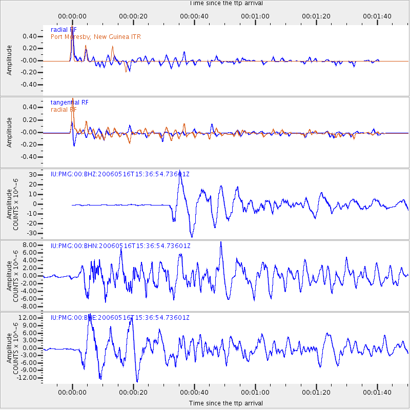
Earthquake location: Northern Sumatra, Indonesia
Earthquake latitude/longitude: 0.1/97.1
Earthquake time(UTC): 2006/05/16 (136) 15:28:25 GMT
Earthquake Depth: 12 km
Earthquake Magnitude: 6.6 MB, 6.8 MS, 6.8 MW, 6.8 MW
Earthquake Catalog/Contributor: WHDF/NEIC
Network: IU Global Seismograph Network (GSN - IRIS/USGS)
Station: PMG Port Moresby, New Guinea
Lat/Lon: 9.41 S/147.15 E
Elevation: 67 m
Distance: 50.8 deg
Az: 102.183 deg
Baz: 277.849 deg
Ray Param: 0.06783663
Estimated Moho Depth: 31.25 km
Estimated Crust Vp/Vs: 1.89
Assumed Crust Vp: 6.122 km/s
Estimated Crust Vs: 3.239 km/s
Estimated Crust Poisson's Ratio: 0.31
Radial Match: 95.73555 %
Radial Bump: 400
Transverse Match: 88.621605 %
Transverse Bump: 400
SOD ConfigId: 2669
Insert Time: 2010-03-02 15:15:59.943 +0000
GWidth: 2.5
Max Bumps: 400
Tol: 0.001

Signal To Noise

ChannelStoNSTALTA
IU:PMG:00:BHN:20060516T15:36:54.73601Z11.4170321.9628897E-61.7192643E-7
IU:PMG:00:BHE:20060516T15:36:54.73601Z11.5465852.872245E-62.4875277E-7
IU:PMG:00:BHZ:20060516T15:36:54.73601Z31.940727.616068E-62.3844385E-7
Arrivals
Ps4.8 SECOND
PpPs14 SECOND
PsPs/PpSs19 SECOND