You are here: Home > Network List > AZ - ANZA Regional Network Stations List
> Station SMER AZ.SMER > Earthquake Result Viewer
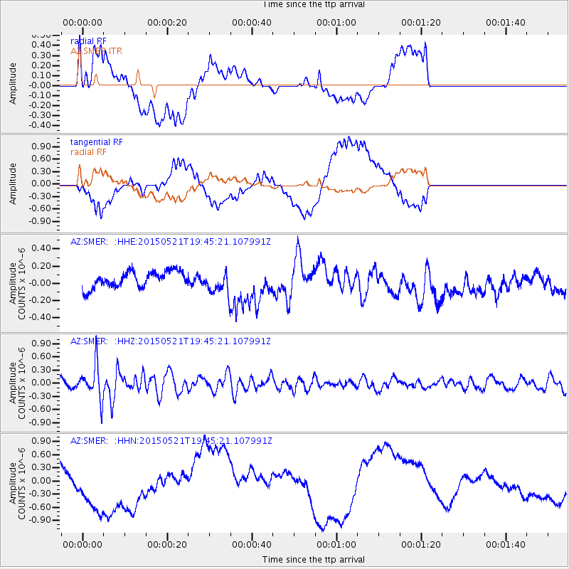
SMER AZ.SMER - Earthquake Result Viewer
*The percent match for this event was below the threshold and hence no stack was calculated.
| Earthquake location: |
Solomon Islands |
| Earthquake latitude/longitude: |
-9.8/160.3 |
| Earthquake time(UTC): |
2015/05/21 (141) 19:32:57 GMT |
| Earthquake Depth: |
10 km |
| Earthquake Magnitude: |
6.0 MWB |
| Earthquake Catalog/Contributor: |
NEIC PDE/NEIC COMCAT |
|
| Network: |
AZ ANZA Regional Network |
| Station: |
SMER AZ.SMER |
| Lat/Lon: |
33.46 N/117.17 W |
| Elevation: |
355 m |
|
| Distance: |
89.1 deg |
| Az: |
55.989 deg |
| Baz: |
257.781 deg |
| Ray Param: |
$rayparam |
*The percent match for this event was below the threshold and hence was not used in the summary stack. |
|
| Radial Match: |
35.02334 % |
| Radial Bump: |
400 |
| Transverse Match: |
29.67762 % |
| Transverse Bump: |
400 |
| SOD ConfigId: |
7422571 |
| Insert Time: |
2019-04-19 00:07:49.150 +0000 |
| GWidth: |
2.5 |
| Max Bumps: |
400 |
| Tol: |
0.001 |
|
Signal To Noise
| Channel | StoN | STA | LTA |
| AZ:SMER: :HHZ:20150521T19:45:21.107991Z | 3.7561944 | 3.9446914E-7 | 1.05018295E-7 |
| AZ:SMER: :HHN:20150521T19:45:21.107991Z | 2.834861 | 6.453541E-7 | 2.2764927E-7 |
| AZ:SMER: :HHE:20150521T19:45:21.107991Z | 2.14126 | 1.903494E-7 | 8.889598E-8 |
| Arrivals |
| Ps | |
| PpPs | |
| PsPs/PpSs | |


