PMG Port Moresby, New Guinea - Earthquake Result Viewer
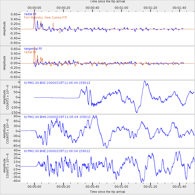
Earthquake location: Volcano Islands, Japan Region
Earthquake latitude/longitude: 22.3/143.7
Earthquake time(UTC): 2000/03/28 (088) 11:00:22 GMT
Earthquake Depth: 126 km
Earthquake Magnitude: 6.8 MB, 7.6 MS, 7.6 MW, 7.6 MW
Earthquake Catalog/Contributor: WHDF/NEIC
Network: IU Global Seismograph Network (GSN - IRIS/USGS)
Station: PMG Port Moresby, New Guinea
Lat/Lon: 9.41 S/147.15 E
Elevation: 67 m
Distance: 31.7 deg
Az: 173.566 deg
Baz: 353.965 deg
Ray Param: 0.07860363
Estimated Moho Depth: 11.5 km
Estimated Crust Vp/Vs: 2.06
Assumed Crust Vp: 6.122 km/s
Estimated Crust Vs: 2.979 km/s
Estimated Crust Poisson's Ratio: 0.34
Radial Match: 97.16204 %
Radial Bump: 299
Transverse Match: 87.581024 %
Transverse Bump: 400
SOD ConfigId: 3744
Insert Time: 2010-03-02 15:16:37.798 +0000
GWidth: 2.5
Max Bumps: 400
Tol: 0.001

Signal To Noise

ChannelStoNSTALTA
IU:PMG:00:BHN:20000328T11:06:04.15801Z16.324152.5610098E-51.5688473E-6
IU:PMG:00:BHE:20000328T11:06:04.15801Z22.5476994.81841E-62.1369853E-7
IU:PMG:00:BHZ:20000328T11:06:04.15801Z25.1622854.692185E-51.864769E-6
Arrivals
Ps2.1 SECOND
PpPs5.4 SECOND
PsPs/PpSs7.5 SECOND