PMG Port Moresby, New Guinea - Earthquake Result Viewer
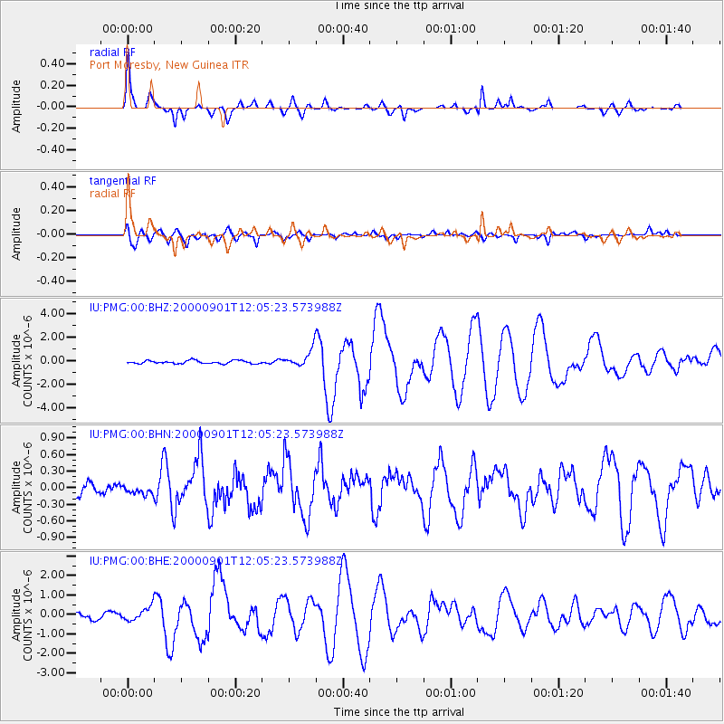
Earthquake location: Off W Coast Of Northern Sumatra
Earthquake latitude/longitude: 1.4/96.6
Earthquake time(UTC): 2000/09/01 (245) 11:56:51 GMT
Earthquake Depth: 33 km
Earthquake Magnitude: 5.6 MB, 6.0 MS, 6.2 MW, 6.0 MW
Earthquake Catalog/Contributor: WHDF/NEIC
Network: IU Global Seismograph Network (GSN - IRIS/USGS)
Station: PMG Port Moresby, New Guinea
Lat/Lon: 9.41 S/147.15 E
Elevation: 67 m
Distance: 51.5 deg
Az: 103.147 deg
Baz: 279.394 deg
Ray Param: 0.06731355
Estimated Moho Depth: 34.25 km
Estimated Crust Vp/Vs: 1.73
Assumed Crust Vp: 6.122 km/s
Estimated Crust Vs: 3.539 km/s
Estimated Crust Poisson's Ratio: 0.25
Radial Match: 95.34485 %
Radial Bump: 348
Transverse Match: 81.9098 %
Transverse Bump: 400
SOD ConfigId: 3744
Insert Time: 2010-03-02 15:16:50.454 +0000
GWidth: 2.5
Max Bumps: 400
Tol: 0.001

Signal To Noise

ChannelStoNSTALTA
IU:PMG:00:BHN:20000901T12:05:23.573988Z0.5937087.6664506E-81.2912831E-7
IU:PMG:00:BHE:20000901T12:05:23.573988Z3.57601453.6620676E-71.024064E-7
IU:PMG:00:BHZ:20000901T12:05:23.573988Z5.6482577.284934E-71.2897667E-7
Arrivals
Ps4.3 SECOND
PpPs14 SECOND
PsPs/PpSs19 SECOND