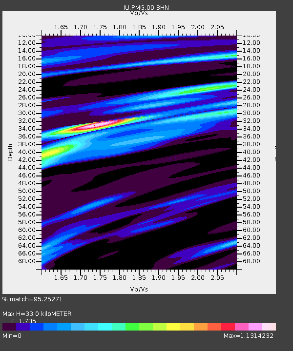
PMG Port Moresby, New Guinea - Earthquake Result Viewer
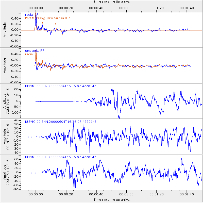
Earthquake location: Southern Sumatra, Indonesia
Earthquake latitude/longitude: -4.7/102.1
Earthquake time(UTC): 2000/06/04 (156) 16:28:26 GMT
Earthquake Depth: 33 km
Earthquake Magnitude: 6.8 MB, 8.0 MS, 7.9 MW, 7.7 MW
Earthquake Catalog/Contributor: WHDF/NEIC
Network: IU Global Seismograph Network (GSN - IRIS/USGS)
Station: PMG Port Moresby, New Guinea
Lat/Lon: 9.41 S/147.15 E
Elevation: 67 m
Distance: 44.9 deg
Az: 98.54 deg
Baz: 272.731 deg
Ray Param: 0.0715388
Estimated Moho Depth: 33.0 km
Estimated Crust Vp/Vs: 1.74
Assumed Crust Vp: 6.122 km/s
Estimated Crust Vs: 3.528 km/s
Estimated Crust Poisson's Ratio: 0.25
Radial Match: 95.25271 %
Radial Bump: 323
Transverse Match: 90.74293 %
Transverse Bump: 400
SOD ConfigId: 3744
Insert Time: 2010-03-02 15:17:09.465 +0000
GWidth: 2.5
Max Bumps: 400
Tol: 0.001

Signal To Noise

ChannelStoNSTALTA
IU:PMG:00:BHN:20000604T16:36:07.422014Z3.19829425.837168E-71.825088E-7
IU:PMG:00:BHE:20000604T16:36:07.422014Z4.08447652.1343005E-65.2253955E-7
IU:PMG:00:BHZ:20000604T16:36:07.422014Z8.5405315.323839E-66.233616E-7
Arrivals
Ps4.2 SECOND
PpPs14 SECOND
PsPs/PpSs18 SECOND