You are here: Home > Network List > TA - USArray Transportable Network (new EarthScope stations) Stations List
> Station A04D Lummi Island, WA, USA > Earthquake Result Viewer
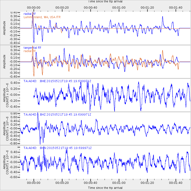
A04D Lummi Island, WA, USA - Earthquake Result Viewer
*The percent match for this event was below the threshold and hence no stack was calculated.
| Earthquake location: |
Solomon Islands |
| Earthquake latitude/longitude: |
-9.8/160.3 |
| Earthquake time(UTC): |
2015/05/21 (141) 19:32:57 GMT |
| Earthquake Depth: |
10 km |
| Earthquake Magnitude: |
6.0 MWB |
| Earthquake Catalog/Contributor: |
NEIC PDE/NEIC COMCAT |
|
| Network: |
TA USArray Transportable Network (new EarthScope stations) |
| Station: |
A04D Lummi Island, WA, USA |
| Lat/Lon: |
48.72 N/122.71 W |
| Elevation: |
13 m |
|
| Distance: |
88.8 deg |
| Az: |
40.189 deg |
| Baz: |
253.837 deg |
| Ray Param: |
$rayparam |
*The percent match for this event was below the threshold and hence was not used in the summary stack. |
|
| Radial Match: |
54.60231 % |
| Radial Bump: |
400 |
| Transverse Match: |
63.39212 % |
| Transverse Bump: |
400 |
| SOD ConfigId: |
7422571 |
| Insert Time: |
2019-04-19 00:11:04.774 +0000 |
| GWidth: |
2.5 |
| Max Bumps: |
400 |
| Tol: |
0.001 |
|
Signal To Noise
| Channel | StoN | STA | LTA |
| TA:A04D: :BHZ:20150521T19:45:19.699971Z | 2.0196233 | 3.3610235E-7 | 1.6641835E-7 |
| TA:A04D: :BHN:20150521T19:45:19.699971Z | 1.0456591 | 1.4238316E-7 | 1.3616594E-7 |
| TA:A04D: :BHE:20150521T19:45:19.699971Z | 1.4054083 | 1.8934891E-7 | 1.3472877E-7 |
| Arrivals |
| Ps | |
| PpPs | |
| PsPs/PpSs | |


