You are here: Home > Network List > UW - Pacific Northwest Regional Seismic Network Stations List
> Station LCCR Mulino, OR, USA > Earthquake Result Viewer
LCCR Mulino, OR, USA - Earthquake Result Viewer
*The percent match for this event was below the threshold and hence no stack was calculated.
| Earthquake location: |
Solomon Islands |
| Earthquake latitude/longitude: |
-9.8/160.3 |
| Earthquake time(UTC): |
2015/05/21 (141) 19:32:57 GMT |
| Earthquake Depth: |
10 km |
| Earthquake Magnitude: |
6.0 MWB |
| Earthquake Catalog/Contributor: |
NEIC PDE/NEIC COMCAT |
|
| Network: |
UW Pacific Northwest Regional Seismic Network |
| Station: |
LCCR Mulino, OR, USA |
| Lat/Lon: |
45.21 N/122.48 W |
| Elevation: |
273 m |
|
| Distance: |
88.0 deg |
| Az: |
43.612 deg |
| Baz: |
254.099 deg |
| Ray Param: |
$rayparam |
*The percent match for this event was below the threshold and hence was not used in the summary stack. |
|
| Radial Match: |
65.6826 % |
| Radial Bump: |
400 |
| Transverse Match: |
58.393406 % |
| Transverse Bump: |
400 |
| SOD ConfigId: |
7422571 |
| Insert Time: |
2019-04-19 00:12:22.166 +0000 |
| GWidth: |
2.5 |
| Max Bumps: |
400 |
| Tol: |
0.001 |
|
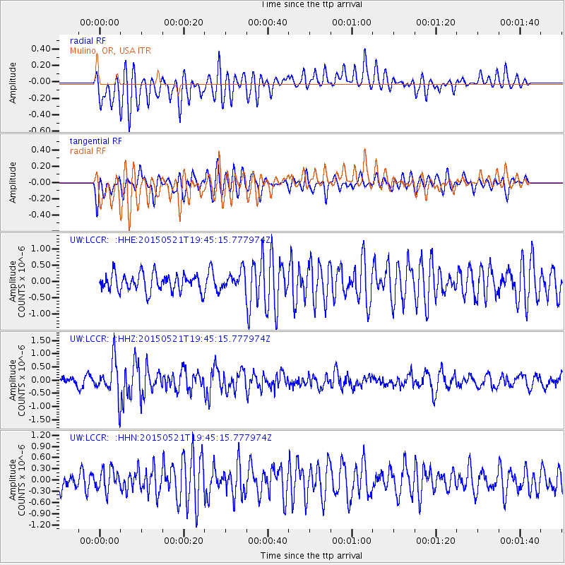
Signal To Noise
| Channel | StoN | STA | LTA |
| UW:LCCR: :HHZ:20150521T19:45:15.777974Z | 4.871012 | 7.1122656E-7 | 1.4601206E-7 |
| UW:LCCR: :HHN:20150521T19:45:15.777974Z | 1.052939 | 2.8762022E-7 | 2.7315943E-7 |
| UW:LCCR: :HHE:20150521T19:45:15.777974Z | 1.4221127 | 3.804329E-7 | 2.675125E-7 |
| Arrivals |
| Ps | |
| PpPs | |
| PsPs/PpSs | |


