You are here: Home > Network List > UW - Pacific Northwest Regional Seismic Network Stations List
> Station MRBL Marblemount, WA, USA > Earthquake Result Viewer
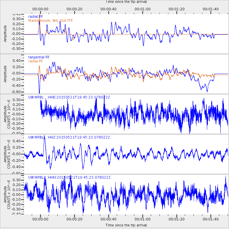
MRBL Marblemount, WA, USA - Earthquake Result Viewer
*The percent match for this event was below the threshold and hence no stack was calculated.
| Earthquake location: |
Solomon Islands |
| Earthquake latitude/longitude: |
-9.8/160.3 |
| Earthquake time(UTC): |
2015/05/21 (141) 19:32:57 GMT |
| Earthquake Depth: |
10 km |
| Earthquake Magnitude: |
6.0 MWB |
| Earthquake Catalog/Contributor: |
NEIC PDE/NEIC COMCAT |
|
| Network: |
UW Pacific Northwest Regional Seismic Network |
| Station: |
MRBL Marblemount, WA, USA |
| Lat/Lon: |
48.52 N/121.48 W |
| Elevation: |
75 m |
|
| Distance: |
89.5 deg |
| Az: |
40.603 deg |
| Baz: |
254.757 deg |
| Ray Param: |
$rayparam |
*The percent match for this event was below the threshold and hence was not used in the summary stack. |
|
| Radial Match: |
56.90246 % |
| Radial Bump: |
400 |
| Transverse Match: |
49.27949 % |
| Transverse Bump: |
400 |
| SOD ConfigId: |
7422571 |
| Insert Time: |
2019-04-19 00:12:27.344 +0000 |
| GWidth: |
2.5 |
| Max Bumps: |
400 |
| Tol: |
0.001 |
|
Signal To Noise
| Channel | StoN | STA | LTA |
| UW:MRBL: :HHZ:20150521T19:45:23.078022Z | 4.1950936 | 2.2717742E-7 | 5.415312E-8 |
| UW:MRBL: :HHN:20150521T19:45:23.078022Z | 1.0972753 | 1.7020368E-7 | 1.5511485E-7 |
| UW:MRBL: :HHE:20150521T19:45:23.078022Z | 1.0538968 | 1.1312901E-7 | 1.0734354E-7 |
| Arrivals |
| Ps | |
| PpPs | |
| PsPs/PpSs | |


