
PMG Port Moresby, New Guinea - Earthquake Result Viewer
| ||||||||||||||||||
| ||||||||||||||||||
| ||||||||||||||||||
|
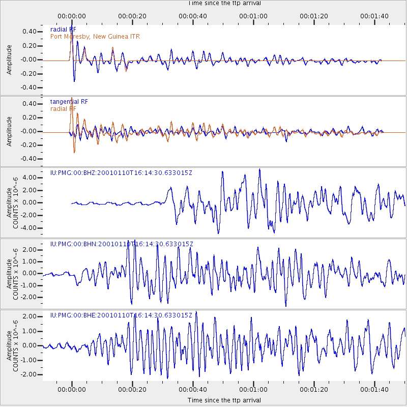
Signal To Noise
| Channel | StoN | STA | LTA |
| IU:PMG:00:BHN:20010110T16:14:30.633015Z | 4.949482 | 4.5883334E-7 | 9.27033E-8 |
| IU:PMG:00:BHE:20010110T16:14:30.633015Z | 1.3162116 | 1.579086E-7 | 1.1997206E-7 |
| IU:PMG:00:BHZ:20010110T16:14:30.633015Z | 11.021109 | 1.5380512E-6 | 1.3955504E-7 |
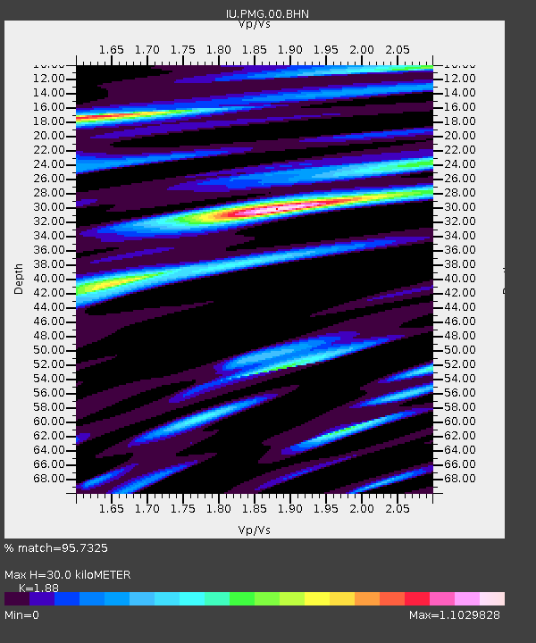
| Arrivals | |
| Ps | 4.4 SECOND |
| PpPs | 14 SECOND |
| PsPs/PpSs | 18 SECOND |

