You are here: Home > Network List > IU - Global Seismograph Network (GSN - IRIS/USGS) Stations List
> Station PMG Port Moresby, New Guinea > Earthquake Result Viewer
PMG Port Moresby, New Guinea - Earthquake Result Viewer
*The percent match for this event was below the threshold and hence no stack was calculated.
| Earthquake location: |
Southeast Of Honshu, Japan |
| Earthquake latitude/longitude: |
29.3/139.0 |
| Earthquake time(UTC): |
1995/10/01 (274) 17:06:03 GMT |
| Earthquake Depth: |
427 km |
| Earthquake Magnitude: |
5.5 MB, 5.8 UNKNOWN, 6.1 MW |
| Earthquake Catalog/Contributor: |
WHDF/NEIC |
|
| Network: |
IU Global Seismograph Network (GSN - IRIS/USGS) |
| Station: |
PMG Port Moresby, New Guinea |
| Lat/Lon: |
9.41 S/147.15 E |
| Elevation: |
67 m |
|
| Distance: |
39.3 deg |
| Az: |
167.162 deg |
| Baz: |
348.658 deg |
| Ray Param: |
$rayparam |
*The percent match for this event was below the threshold and hence was not used in the summary stack. |
|
| Radial Match: |
59.97335 % |
| Radial Bump: |
400 |
| Transverse Match: |
70.13281 % |
| Transverse Bump: |
400 |
| SOD ConfigId: |
4480 |
| Insert Time: |
2010-03-02 15:18:55.765 +0000 |
| GWidth: |
2.5 |
| Max Bumps: |
400 |
| Tol: |
0.001 |
|
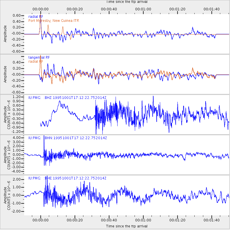
Signal To Noise
| Channel | StoN | STA | LTA |
| IU:PMG: :BHN:19951001T17:12:22.752014Z | 2.59452 | 1.0388952E-6 | 4.0041903E-7 |
| IU:PMG: :BHE:19951001T17:12:22.752014Z | 2.9611793 | 8.281393E-7 | 2.796654E-7 |
| IU:PMG: :BHZ:19951001T17:12:22.752014Z | 0.9112103 | 4.3341757E-7 | 4.756504E-7 |
| Arrivals |
| Ps | |
| PpPs | |
| PsPs/PpSs | |


