You are here: Home > Network List > IU - Global Seismograph Network (GSN - IRIS/USGS) Stations List
> Station PMG Port Moresby, New Guinea > Earthquake Result Viewer
PMG Port Moresby, New Guinea - Earthquake Result Viewer
*The percent match for this event was below the threshold and hence no stack was calculated.
| Earthquake location: |
Southwest Of Sumatra, Indonesia |
| Earthquake latitude/longitude: |
-6.0/101.9 |
| Earthquake time(UTC): |
2009/04/01 (091) 06:29:40 GMT |
| Earthquake Depth: |
35 km |
| Earthquake Magnitude: |
5.6 MW, 5.2 MS, 5.3 MB |
| Earthquake Catalog/Contributor: |
WHDF/NEIC |
|
| Network: |
IU Global Seismograph Network (GSN - IRIS/USGS) |
| Station: |
PMG Port Moresby, New Guinea |
| Lat/Lon: |
9.41 S/147.15 E |
| Elevation: |
67 m |
|
| Distance: |
44.9 deg |
| Az: |
97.308 deg |
| Baz: |
270.966 deg |
| Ray Param: |
$rayparam |
*The percent match for this event was below the threshold and hence was not used in the summary stack. |
|
| Radial Match: |
62.297195 % |
| Radial Bump: |
400 |
| Transverse Match: |
63.843155 % |
| Transverse Bump: |
400 |
| SOD ConfigId: |
2760 |
| Insert Time: |
2010-03-02 15:19:11.926 +0000 |
| GWidth: |
2.5 |
| Max Bumps: |
400 |
| Tol: |
0.001 |
|
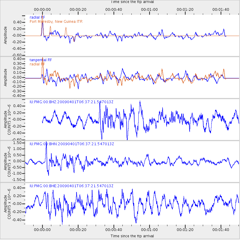
Signal To Noise
| Channel | StoN | STA | LTA |
| IU:PMG:00:BHN:20090401T06:37:21.547013Z | 5.60227 | 5.769797E-7 | 1.02990334E-7 |
| IU:PMG:00:BHE:20090401T06:37:21.547013Z | 1.669422 | 2.0157114E-7 | 1.2074307E-7 |
| IU:PMG:00:BHZ:20090401T06:37:21.547013Z | 2.0168028 | 2.4395848E-7 | 1.2096298E-7 |
| Arrivals |
| Ps | |
| PpPs | |
| PsPs/PpSs | |


