You are here: Home > Network List > IU - Global Seismograph Network (GSN - IRIS/USGS) Stations List
> Station PMG Port Moresby, New Guinea > Earthquake Result Viewer
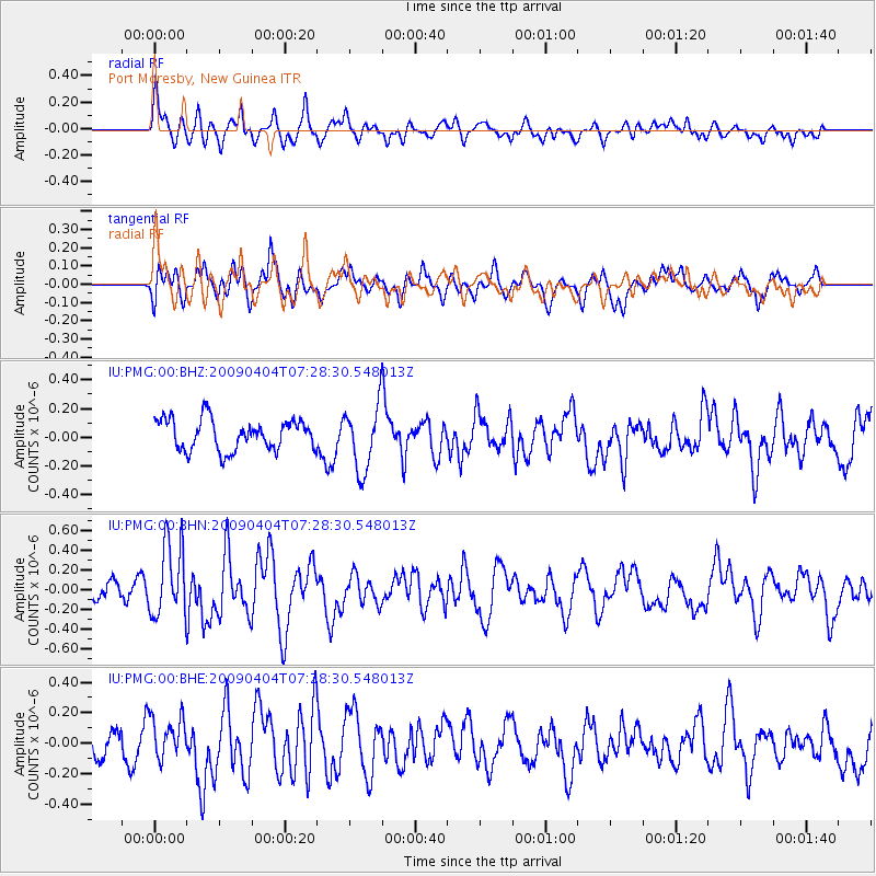
PMG Port Moresby, New Guinea - Earthquake Result Viewer
*The percent match for this event was below the threshold and hence no stack was calculated.
| Earthquake location: |
Balleny Islands Region |
| Earthquake latitude/longitude: |
-62.6/155.1 |
| Earthquake time(UTC): |
2009/04/04 (094) 07:19:41 GMT |
| Earthquake Depth: |
10 km |
| Earthquake Magnitude: |
5.7 MS, 5.3 MB, 5.9 MW, 5.9 MW |
| Earthquake Catalog/Contributor: |
WHDF/NEIC |
|
| Network: |
IU Global Seismograph Network (GSN - IRIS/USGS) |
| Station: |
PMG Port Moresby, New Guinea |
| Lat/Lon: |
9.41 S/147.15 E |
| Elevation: |
67 m |
|
| Distance: |
53.4 deg |
| Az: |
350.198 deg |
| Baz: |
175.421 deg |
| Ray Param: |
$rayparam |
*The percent match for this event was below the threshold and hence was not used in the summary stack. |
|
| Radial Match: |
68.86712 % |
| Radial Bump: |
400 |
| Transverse Match: |
58.716114 % |
| Transverse Bump: |
400 |
| SOD ConfigId: |
2760 |
| Insert Time: |
2010-03-02 15:19:13.888 +0000 |
| GWidth: |
2.5 |
| Max Bumps: |
400 |
| Tol: |
0.001 |
|
Signal To Noise
| Channel | StoN | STA | LTA |
| IU:PMG:00:BHN:20090404T07:28:30.548013Z | 4.106635 | 3.7488496E-7 | 9.1287625E-8 |
| IU:PMG:00:BHE:20090404T07:28:30.548013Z | 1.1719164 | 1.4012076E-7 | 1.195655E-7 |
| IU:PMG:00:BHZ:20090404T07:28:30.548013Z | 2.1205451 | 2.2529984E-7 | 1.0624619E-7 |
| Arrivals |
| Ps | |
| PpPs | |
| PsPs/PpSs | |


