You are here: Home > Network List > IU - Global Seismograph Network (GSN - IRIS/USGS) Stations List
> Station PMG Port Moresby, New Guinea > Earthquake Result Viewer
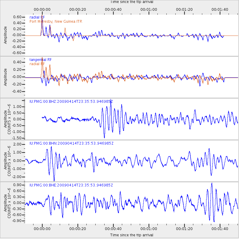
PMG Port Moresby, New Guinea - Earthquake Result Viewer
*The percent match for this event was below the threshold and hence no stack was calculated.
| Earthquake location: |
Fiji Islands Region |
| Earthquake latitude/longitude: |
-16.3/-177.7 |
| Earthquake time(UTC): |
2009/04/14 (104) 23:29:33 GMT |
| Earthquake Depth: |
10 km |
| Earthquake Magnitude: |
5.5 MS, 5.4 MB, 5.9 MW, 5.9 MW |
| Earthquake Catalog/Contributor: |
WHDF/NEIC |
|
| Network: |
IU Global Seismograph Network (GSN - IRIS/USGS) |
| Station: |
PMG Port Moresby, New Guinea |
| Lat/Lon: |
9.41 S/147.15 E |
| Elevation: |
67 m |
|
| Distance: |
34.9 deg |
| Az: |
276.96 deg |
| Baz: |
104.978 deg |
| Ray Param: |
$rayparam |
*The percent match for this event was below the threshold and hence was not used in the summary stack. |
|
| Radial Match: |
75.68708 % |
| Radial Bump: |
400 |
| Transverse Match: |
65.74119 % |
| Transverse Bump: |
377 |
| SOD ConfigId: |
2760 |
| Insert Time: |
2010-03-02 15:19:21.319 +0000 |
| GWidth: |
2.5 |
| Max Bumps: |
400 |
| Tol: |
0.001 |
|
Signal To Noise
| Channel | StoN | STA | LTA |
| IU:PMG:00:BHN:20090414T23:35:53.946985Z | 5.4176683 | 8.030769E-7 | 1.4823294E-7 |
| IU:PMG:00:BHE:20090414T23:35:53.946985Z | 1.8069295 | 2.283758E-7 | 1.2638888E-7 |
| IU:PMG:00:BHZ:20090414T23:35:53.946985Z | 4.046056 | 4.415011E-7 | 1.09118886E-7 |
| Arrivals |
| Ps | |
| PpPs | |
| PsPs/PpSs | |


