You are here: Home > Network List > IU - Global Seismograph Network (GSN - IRIS/USGS) Stations List
> Station PMG Port Moresby, New Guinea > Earthquake Result Viewer
PMG Port Moresby, New Guinea - Earthquake Result Viewer
*The percent match for this event was below the threshold and hence no stack was calculated.
| Earthquake location: |
Tonga Islands |
| Earthquake latitude/longitude: |
-15.1/-173.5 |
| Earthquake time(UTC): |
1995/11/13 (317) 07:38:45 GMT |
| Earthquake Depth: |
33 km |
| Earthquake Magnitude: |
5.7 MB, 5.9 MS, 6.1 UNKNOWN, 6.0 MW |
| Earthquake Catalog/Contributor: |
WHDF/NEIC |
|
| Network: |
IU Global Seismograph Network (GSN - IRIS/USGS) |
| Station: |
PMG Port Moresby, New Guinea |
| Lat/Lon: |
9.41 S/147.15 E |
| Elevation: |
67 m |
|
| Distance: |
38.8 deg |
| Az: |
273.719 deg |
| Baz: |
102.353 deg |
| Ray Param: |
$rayparam |
*The percent match for this event was below the threshold and hence was not used in the summary stack. |
|
| Radial Match: |
75.380844 % |
| Radial Bump: |
400 |
| Transverse Match: |
76.50117 % |
| Transverse Bump: |
400 |
| SOD ConfigId: |
4480 |
| Insert Time: |
2010-03-02 15:19:22.908 +0000 |
| GWidth: |
2.5 |
| Max Bumps: |
400 |
| Tol: |
0.001 |
|
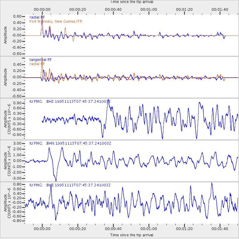
Signal To Noise
| Channel | StoN | STA | LTA |
| IU:PMG: :BHN:19951113T07:45:37.241003Z | 9.329812 | 8.853286E-7 | 9.4892435E-8 |
| IU:PMG: :BHE:19951113T07:45:37.241003Z | 2.0778127 | 2.1167627E-7 | 1.0187456E-7 |
| IU:PMG: :BHZ:19951113T07:45:37.241003Z | 3.9445002 | 4.0227184E-7 | 1.0198297E-7 |
| Arrivals |
| Ps | |
| PpPs | |
| PsPs/PpSs | |


