You are here: Home > Network List > IU - Global Seismograph Network (GSN - IRIS/USGS) Stations List
> Station PMG Port Moresby, New Guinea > Earthquake Result Viewer
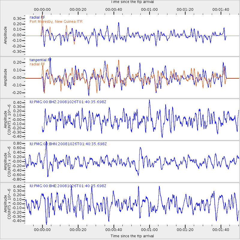
PMG Port Moresby, New Guinea - Earthquake Result Viewer
*The percent match for this event was below the threshold and hence no stack was calculated.
| Earthquake location: |
Hindu Kush Region, Afghanistan |
| Earthquake latitude/longitude: |
36.5/70.7 |
| Earthquake time(UTC): |
2008/10/26 (300) 01:28:56 GMT |
| Earthquake Depth: |
210 km |
| Earthquake Magnitude: |
5.5 MB, 5.7 MW, 5.7 MW |
| Earthquake Catalog/Contributor: |
WHDF/NEIC |
|
| Network: |
IU Global Seismograph Network (GSN - IRIS/USGS) |
| Station: |
PMG Port Moresby, New Guinea |
| Lat/Lon: |
9.41 S/147.15 E |
| Elevation: |
67 m |
|
| Distance: |
84.8 deg |
| Az: |
105.584 deg |
| Baz: |
308.123 deg |
| Ray Param: |
$rayparam |
*The percent match for this event was below the threshold and hence was not used in the summary stack. |
|
| Radial Match: |
54.90328 % |
| Radial Bump: |
400 |
| Transverse Match: |
55.760254 % |
| Transverse Bump: |
400 |
| SOD ConfigId: |
2560 |
| Insert Time: |
2010-03-02 15:19:27.821 +0000 |
| GWidth: |
2.5 |
| Max Bumps: |
400 |
| Tol: |
0.001 |
|
Signal To Noise
| Channel | StoN | STA | LTA |
| IU:PMG:00:BHN:20081026T01:40:35.698Z | 2.7615478 | 3.8250772E-7 | 1.3851208E-7 |
| IU:PMG:00:BHE:20081026T01:40:35.698Z | 2.0792367 | 2.1730723E-7 | 1.04512985E-7 |
| IU:PMG:00:BHZ:20081026T01:40:35.698Z | 0.97533345 | 1.1270676E-7 | 1.1555716E-7 |
| Arrivals |
| Ps | |
| PpPs | |
| PsPs/PpSs | |


