You are here: Home > Network List > IU - Global Seismograph Network (GSN - IRIS/USGS) Stations List
> Station PMG Port Moresby, New Guinea > Earthquake Result Viewer
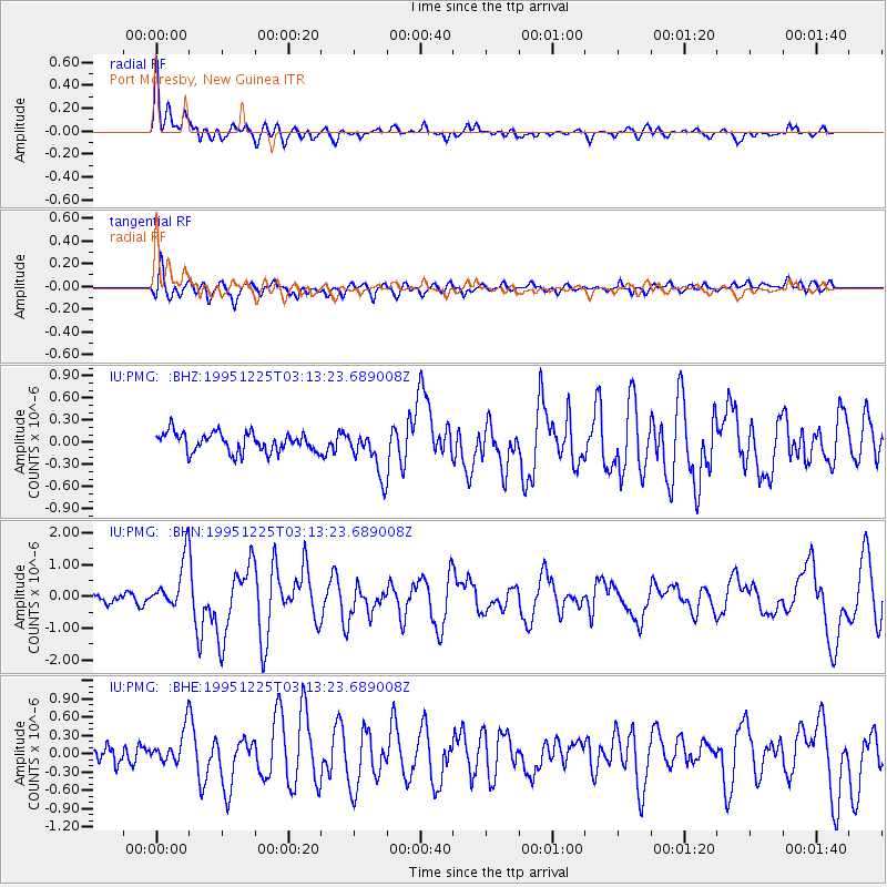
PMG Port Moresby, New Guinea - Earthquake Result Viewer
*The percent match for this event was below the threshold and hence no stack was calculated.
| Earthquake location: |
Kermadec Islands Region |
| Earthquake latitude/longitude: |
-28.2/-176.9 |
| Earthquake time(UTC): |
1995/12/25 (359) 03:06:34 GMT |
| Earthquake Depth: |
33 km |
| Earthquake Magnitude: |
5.4 MB, 6.0 MS |
| Earthquake Catalog/Contributor: |
WHDF/NEIC |
|
| Network: |
IU Global Seismograph Network (GSN - IRIS/USGS) |
| Station: |
PMG Port Moresby, New Guinea |
| Lat/Lon: |
9.41 S/147.15 E |
| Elevation: |
67 m |
|
| Distance: |
38.6 deg |
| Az: |
291.816 deg |
| Baz: |
123.83 deg |
| Ray Param: |
$rayparam |
*The percent match for this event was below the threshold and hence was not used in the summary stack. |
|
| Radial Match: |
79.354515 % |
| Radial Bump: |
400 |
| Transverse Match: |
77.90369 % |
| Transverse Bump: |
400 |
| SOD ConfigId: |
4480 |
| Insert Time: |
2010-03-02 15:19:35.543 +0000 |
| GWidth: |
2.5 |
| Max Bumps: |
400 |
| Tol: |
0.001 |
|
Signal To Noise
| Channel | StoN | STA | LTA |
| IU:PMG: :BHN:19951225T03:13:23.689008Z | 5.9057765 | 7.9021453E-7 | 1.3380367E-7 |
| IU:PMG: :BHE:19951225T03:13:23.689008Z | 2.3902094 | 2.76834E-7 | 1.1581997E-7 |
| IU:PMG: :BHZ:19951225T03:13:23.689008Z | 2.3588574 | 3.0796417E-7 | 1.305565E-7 |
| Arrivals |
| Ps | |
| PpPs | |
| PsPs/PpSs | |


