You are here: Home > Network List > IU - Global Seismograph Network (GSN - IRIS/USGS) Stations List
> Station PMG Port Moresby, New Guinea > Earthquake Result Viewer
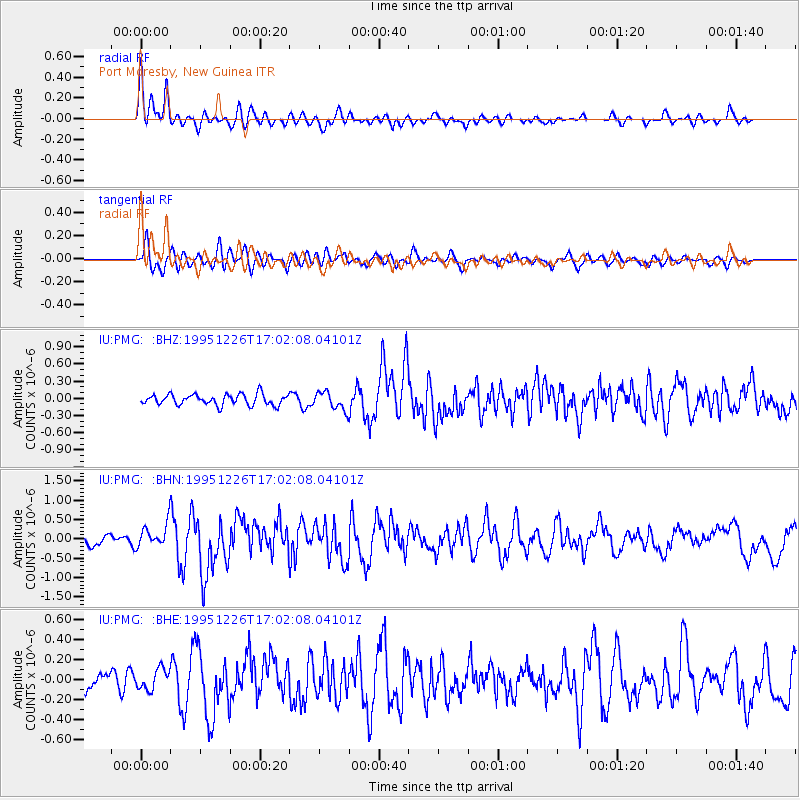
PMG Port Moresby, New Guinea - Earthquake Result Viewer
*The percent match for this event was below the threshold and hence no stack was calculated.
| Earthquake location: |
Tonga Islands |
| Earthquake latitude/longitude: |
-21.4/-174.8 |
| Earthquake time(UTC): |
1995/12/26 (360) 16:55:19 GMT |
| Earthquake Depth: |
33 km |
| Earthquake Magnitude: |
5.4 MB, 5.9 MS, 5.9 UNKNOWN, 5.7 MW |
| Earthquake Catalog/Contributor: |
WHDF/NEIC |
|
| Network: |
IU Global Seismograph Network (GSN - IRIS/USGS) |
| Station: |
PMG Port Moresby, New Guinea |
| Lat/Lon: |
9.41 S/147.15 E |
| Elevation: |
67 m |
|
| Distance: |
38.5 deg |
| Az: |
282.097 deg |
| Baz: |
112.559 deg |
| Ray Param: |
$rayparam |
*The percent match for this event was below the threshold and hence was not used in the summary stack. |
|
| Radial Match: |
77.1102 % |
| Radial Bump: |
400 |
| Transverse Match: |
65.91477 % |
| Transverse Bump: |
400 |
| SOD ConfigId: |
4480 |
| Insert Time: |
2010-03-02 15:19:36.185 +0000 |
| GWidth: |
2.5 |
| Max Bumps: |
400 |
| Tol: |
0.001 |
|
Signal To Noise
| Channel | StoN | STA | LTA |
| IU:PMG: :BHN:19951226T17:02:08.04101Z | 2.4561174 | 3.0736027E-7 | 1.2514072E-7 |
| IU:PMG: :BHE:19951226T17:02:08.04101Z | 1.0963038 | 1.03336504E-7 | 9.4259E-8 |
| IU:PMG: :BHZ:19951226T17:02:08.04101Z | 1.6622871 | 1.5538215E-7 | 9.3474924E-8 |
| Arrivals |
| Ps | |
| PpPs | |
| PsPs/PpSs | |


