You are here: Home > Network List > IU - Global Seismograph Network (GSN - IRIS/USGS) Stations List
> Station PMG Port Moresby, New Guinea > Earthquake Result Viewer
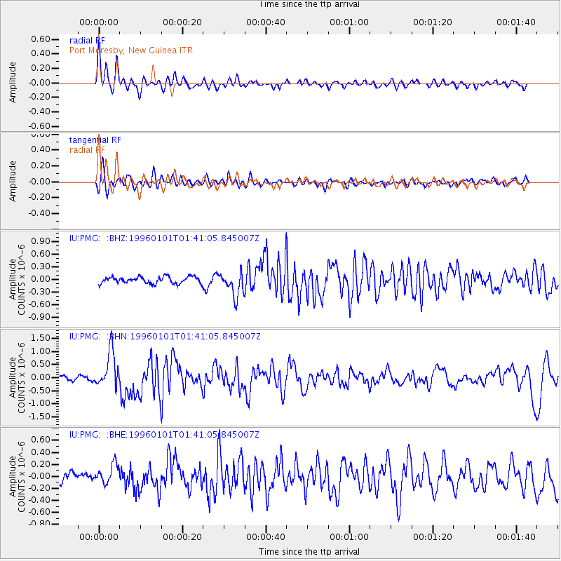
PMG Port Moresby, New Guinea - Earthquake Result Viewer
*The percent match for this event was below the threshold and hence no stack was calculated.
| Earthquake location: |
Tonga Islands |
| Earthquake latitude/longitude: |
-20.3/-174.4 |
| Earthquake time(UTC): |
1996/01/01 (001) 01:34:15 GMT |
| Earthquake Depth: |
33 km |
| Earthquake Magnitude: |
5.8 MS, 5.3 MB |
| Earthquake Catalog/Contributor: |
WHDF/NEIC |
|
| Network: |
IU Global Seismograph Network (GSN - IRIS/USGS) |
| Station: |
PMG Port Moresby, New Guinea |
| Lat/Lon: |
9.41 S/147.15 E |
| Elevation: |
67 m |
|
| Distance: |
38.7 deg |
| Az: |
280.532 deg |
| Baz: |
110.749 deg |
| Ray Param: |
$rayparam |
*The percent match for this event was below the threshold and hence was not used in the summary stack. |
|
| Radial Match: |
81.31101 % |
| Radial Bump: |
400 |
| Transverse Match: |
63.72587 % |
| Transverse Bump: |
400 |
| SOD ConfigId: |
4480 |
| Insert Time: |
2010-03-02 15:19:39.610 +0000 |
| GWidth: |
2.5 |
| Max Bumps: |
400 |
| Tol: |
0.001 |
|
Signal To Noise
| Channel | StoN | STA | LTA |
| IU:PMG: :BHN:19960101T01:41:05.845007Z | 8.876505 | 7.17317E-7 | 8.081075E-8 |
| IU:PMG: :BHE:19960101T01:41:05.845007Z | 1.9344766 | 1.6580124E-7 | 8.570858E-8 |
| IU:PMG: :BHZ:19960101T01:41:05.845007Z | 3.775103 | 2.926628E-7 | 7.7524454E-8 |
| Arrivals |
| Ps | |
| PpPs | |
| PsPs/PpSs | |


