You are here: Home > Network List > IU - Global Seismograph Network (GSN - IRIS/USGS) Stations List
> Station PMG Port Moresby, New Guinea > Earthquake Result Viewer
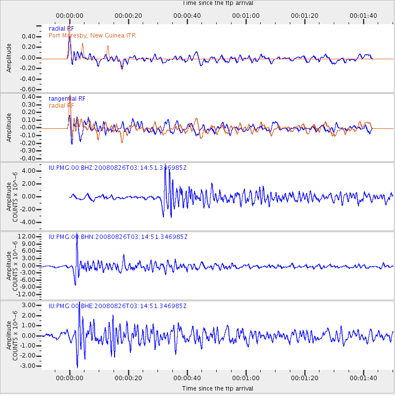
PMG Port Moresby, New Guinea - Earthquake Result Viewer
*The percent match for this event was below the threshold and hence no stack was calculated.
| Earthquake location: |
Sunda Strait, Indonesia |
| Earthquake latitude/longitude: |
-6.3/104.5 |
| Earthquake time(UTC): |
2008/08/26 (239) 03:07:29 GMT |
| Earthquake Depth: |
22 km |
| Earthquake Magnitude: |
5.7 MB, 5.4 MS, 5.7 MW, 5.7 MW |
| Earthquake Catalog/Contributor: |
WHDF/NEIC |
|
| Network: |
IU Global Seismograph Network (GSN - IRIS/USGS) |
| Station: |
PMG Port Moresby, New Guinea |
| Lat/Lon: |
9.41 S/147.15 E |
| Elevation: |
67 m |
|
| Distance: |
42.4 deg |
| Az: |
96.98 deg |
| Baz: |
270.89 deg |
| Ray Param: |
$rayparam |
*The percent match for this event was below the threshold and hence was not used in the summary stack. |
|
| Radial Match: |
78.205246 % |
| Radial Bump: |
400 |
| Transverse Match: |
72.3504 % |
| Transverse Bump: |
400 |
| SOD ConfigId: |
2504 |
| Insert Time: |
2010-03-02 15:19:55.405 +0000 |
| GWidth: |
2.5 |
| Max Bumps: |
400 |
| Tol: |
0.001 |
|
Signal To Noise
| Channel | StoN | STA | LTA |
| IU:PMG:00:BHN:20080826T03:14:51.346985Z | 14.875444 | 3.9585825E-6 | 2.6611525E-7 |
| IU:PMG:00:BHE:20080826T03:14:51.346985Z | 6.4246035 | 1.2428211E-6 | 1.9344714E-7 |
| IU:PMG:00:BHZ:20080826T03:14:51.346985Z | 8.522759 | 1.9160493E-6 | 2.2481558E-7 |
| Arrivals |
| Ps | |
| PpPs | |
| PsPs/PpSs | |


