You are here: Home > Network List > IU - Global Seismograph Network (GSN - IRIS/USGS) Stations List
> Station PMG Port Moresby, New Guinea > Earthquake Result Viewer
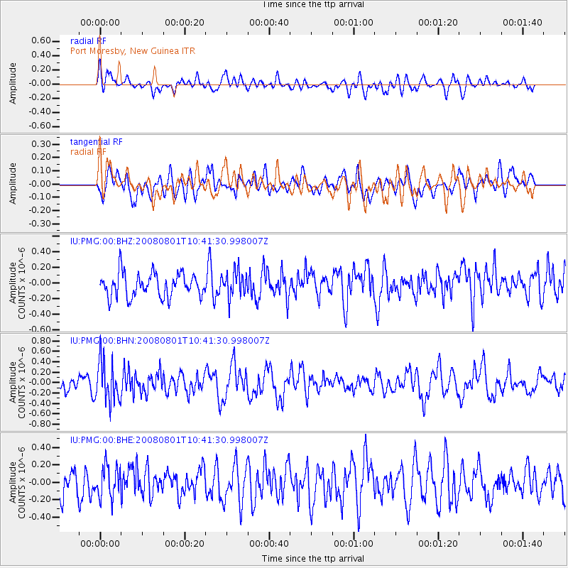
PMG Port Moresby, New Guinea - Earthquake Result Viewer
*The percent match for this event was below the threshold and hence no stack was calculated.
| Earthquake location: |
Mindoro, Philippines |
| Earthquake latitude/longitude: |
13.5/120.8 |
| Earthquake time(UTC): |
2008/08/01 (214) 10:35:24 GMT |
| Earthquake Depth: |
135 km |
| Earthquake Magnitude: |
5.6 MW, 5.3 MB, 5.5 MW |
| Earthquake Catalog/Contributor: |
WHDF/NEIC |
|
| Network: |
IU Global Seismograph Network (GSN - IRIS/USGS) |
| Station: |
PMG Port Moresby, New Guinea |
| Lat/Lon: |
9.41 S/147.15 E |
| Elevation: |
67 m |
|
| Distance: |
34.7 deg |
| Az: |
129.625 deg |
| Baz: |
310.602 deg |
| Ray Param: |
$rayparam |
*The percent match for this event was below the threshold and hence was not used in the summary stack. |
|
| Radial Match: |
44.294678 % |
| Radial Bump: |
400 |
| Transverse Match: |
48.783184 % |
| Transverse Bump: |
400 |
| SOD ConfigId: |
2504 |
| Insert Time: |
2010-03-02 15:20:12.604 +0000 |
| GWidth: |
2.5 |
| Max Bumps: |
400 |
| Tol: |
0.001 |
|
Signal To Noise
| Channel | StoN | STA | LTA |
| IU:PMG:00:BHN:20080801T10:41:30.998007Z | 2.9357142 | 3.9422872E-7 | 1.3428716E-7 |
| IU:PMG:00:BHE:20080801T10:41:30.998007Z | 0.8969257 | 1.8381976E-7 | 2.0494426E-7 |
| IU:PMG:00:BHZ:20080801T10:41:30.998007Z | 1.0819381 | 1.6399062E-7 | 1.5157116E-7 |
| Arrivals |
| Ps | |
| PpPs | |
| PsPs/PpSs | |


