You are here: Home > Network List > IU - Global Seismograph Network (GSN - IRIS/USGS) Stations List
> Station CTAO Charters Towers, Australia > Earthquake Result Viewer
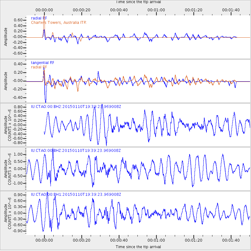
CTAO Charters Towers, Australia - Earthquake Result Viewer
*The percent match for this event was below the threshold and hence no stack was calculated.
| Earthquake location: |
Luzon, Philippines |
| Earthquake latitude/longitude: |
14.8/120.3 |
| Earthquake time(UTC): |
2015/01/10 (010) 19:32:02 GMT |
| Earthquake Depth: |
75 km |
| Earthquake Magnitude: |
5.8 MWB |
| Earthquake Catalog/Contributor: |
NEIC PDE/NEIC COMCAT |
|
| Network: |
IU Global Seismograph Network (GSN - IRIS/USGS) |
| Station: |
CTAO Charters Towers, Australia |
| Lat/Lon: |
20.09 S/146.25 E |
| Elevation: |
357 m |
|
| Distance: |
43.0 deg |
| Az: |
142.902 deg |
| Baz: |
321.625 deg |
| Ray Param: |
$rayparam |
*The percent match for this event was below the threshold and hence was not used in the summary stack. |
|
| Radial Match: |
42.11969 % |
| Radial Bump: |
400 |
| Transverse Match: |
73.05506 % |
| Transverse Bump: |
400 |
| SOD ConfigId: |
828811 |
| Insert Time: |
2015-01-24 19:54:02.478 +0000 |
| GWidth: |
2.5 |
| Max Bumps: |
400 |
| Tol: |
0.001 |
|
Signal To Noise
| Channel | StoN | STA | LTA |
| IU:CTAO:00:BHZ:20150110T19:39:23.969008Z | 2.9220634 | 6.997906E-7 | 2.3948508E-7 |
| IU:CTAO:00:BH1:20150110T19:39:23.969008Z | 2.8199427 | 6.1396025E-7 | 2.1772082E-7 |
| IU:CTAO:00:BH2:20150110T19:39:23.969008Z | 2.071055 | 5.6963125E-7 | 2.7504402E-7 |
| Arrivals |
| Ps | |
| PpPs | |
| PsPs/PpSs | |


