You are here: Home > Network List > IU - Global Seismograph Network (GSN - IRIS/USGS) Stations List
> Station PMG Port Moresby, New Guinea > Earthquake Result Viewer
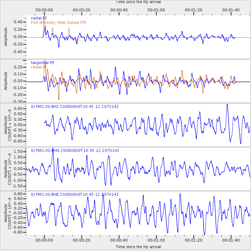
PMG Port Moresby, New Guinea - Earthquake Result Viewer
*The percent match for this event was below the threshold and hence no stack was calculated.
| Earthquake location: |
West Of Macquarie Island |
| Earthquake latitude/longitude: |
-60.7/153.8 |
| Earthquake time(UTC): |
2008/08/09 (222) 16:36:38 GMT |
| Earthquake Depth: |
10 km |
| Earthquake Magnitude: |
5.7 MB, 6.0 MS, 6.3 MW, 6.3 MW |
| Earthquake Catalog/Contributor: |
WHDF/NEIC |
|
| Network: |
IU Global Seismograph Network (GSN - IRIS/USGS) |
| Station: |
PMG Port Moresby, New Guinea |
| Lat/Lon: |
9.41 S/147.15 E |
| Elevation: |
67 m |
|
| Distance: |
51.4 deg |
| Az: |
351.567 deg |
| Baz: |
175.807 deg |
| Ray Param: |
$rayparam |
*The percent match for this event was below the threshold and hence was not used in the summary stack. |
|
| Radial Match: |
69.237595 % |
| Radial Bump: |
392 |
| Transverse Match: |
55.413784 % |
| Transverse Bump: |
368 |
| SOD ConfigId: |
2504 |
| Insert Time: |
2010-03-02 15:20:16.553 +0000 |
| GWidth: |
2.5 |
| Max Bumps: |
400 |
| Tol: |
0.001 |
|
Signal To Noise
| Channel | StoN | STA | LTA |
| IU:PMG:00:BHN:20080809T16:45:12.297014Z | 2.5166798 | 6.446567E-7 | 2.5615364E-7 |
| IU:PMG:00:BHE:20080809T16:45:12.297014Z | 1.1774812 | 2.8535663E-7 | 2.4234495E-7 |
| IU:PMG:00:BHZ:20080809T16:45:12.297014Z | 0.4547334 | 1.2523066E-7 | 2.7539357E-7 |
| Arrivals |
| Ps | |
| PpPs | |
| PsPs/PpSs | |


