You are here: Home > Network List > IU - Global Seismograph Network (GSN - IRIS/USGS) Stations List
> Station PMG Port Moresby, New Guinea > Earthquake Result Viewer
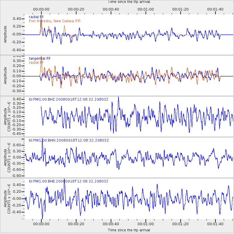
PMG Port Moresby, New Guinea - Earthquake Result Viewer
*The percent match for this event was below the threshold and hence no stack was calculated.
| Earthquake location: |
Near East Coast Of Kamchatka |
| Earthquake latitude/longitude: |
51.9/158.4 |
| Earthquake time(UTC): |
2008/09/18 (262) 11:58:50 GMT |
| Earthquake Depth: |
67 km |
| Earthquake Magnitude: |
5.7 MB, 5.9 MW, 5.8 MW |
| Earthquake Catalog/Contributor: |
WHDF/NEIC |
|
| Network: |
IU Global Seismograph Network (GSN - IRIS/USGS) |
| Station: |
PMG Port Moresby, New Guinea |
| Lat/Lon: |
9.41 S/147.15 E |
| Elevation: |
67 m |
|
| Distance: |
61.8 deg |
| Az: |
192.591 deg |
| Baz: |
7.864 deg |
| Ray Param: |
$rayparam |
*The percent match for this event was below the threshold and hence was not used in the summary stack. |
|
| Radial Match: |
51.995316 % |
| Radial Bump: |
400 |
| Transverse Match: |
40.770695 % |
| Transverse Bump: |
400 |
| SOD ConfigId: |
2560 |
| Insert Time: |
2010-03-02 15:20:25.294 +0000 |
| GWidth: |
2.5 |
| Max Bumps: |
400 |
| Tol: |
0.001 |
|
Signal To Noise
| Channel | StoN | STA | LTA |
| IU:PMG:00:BHN:20080918T12:08:32.29803Z | 2.7322521 | 3.1338834E-7 | 1.14699645E-7 |
| IU:PMG:00:BHE:20080918T12:08:32.29803Z | 1.7356819 | 2.3851928E-7 | 1.3742107E-7 |
| IU:PMG:00:BHZ:20080918T12:08:32.29803Z | 0.999601 | 1.1093331E-7 | 1.1097758E-7 |
| Arrivals |
| Ps | |
| PpPs | |
| PsPs/PpSs | |


