You are here: Home > Network List > IU - Global Seismograph Network (GSN - IRIS/USGS) Stations List
> Station PMG Port Moresby, New Guinea > Earthquake Result Viewer
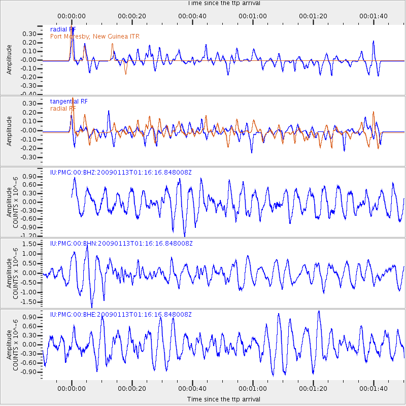
PMG Port Moresby, New Guinea - Earthquake Result Viewer
*The percent match for this event was below the threshold and hence no stack was calculated.
| Earthquake location: |
Mid-Indian Ridge |
| Earthquake latitude/longitude: |
-13.1/66.1 |
| Earthquake time(UTC): |
2009/01/13 (013) 01:04:42 GMT |
| Earthquake Depth: |
10 km |
| Earthquake Magnitude: |
5.5 MB, 5.6 MS, 6.0 MW, 6.0 MW |
| Earthquake Catalog/Contributor: |
WHDF/NEIC |
|
| Network: |
IU Global Seismograph Network (GSN - IRIS/USGS) |
| Station: |
PMG Port Moresby, New Guinea |
| Lat/Lon: |
9.41 S/147.15 E |
| Elevation: |
67 m |
|
| Distance: |
79.3 deg |
| Az: |
97.228 deg |
| Baz: |
258.347 deg |
| Ray Param: |
$rayparam |
*The percent match for this event was below the threshold and hence was not used in the summary stack. |
|
| Radial Match: |
66.69997 % |
| Radial Bump: |
400 |
| Transverse Match: |
47.728546 % |
| Transverse Bump: |
400 |
| SOD ConfigId: |
2834 |
| Insert Time: |
2010-03-02 15:20:27.516 +0000 |
| GWidth: |
2.5 |
| Max Bumps: |
400 |
| Tol: |
0.001 |
|
Signal To Noise
| Channel | StoN | STA | LTA |
| IU:PMG:00:BHN:20090113T01:16:16.848008Z | 3.3156645 | 7.986496E-7 | 2.4087163E-7 |
| IU:PMG:00:BHE:20090113T01:16:16.848008Z | 0.6035445 | 2.420783E-7 | 4.010944E-7 |
| IU:PMG:00:BHZ:20090113T01:16:16.848008Z | 1.2906917 | 4.312427E-7 | 3.3411752E-7 |
| Arrivals |
| Ps | |
| PpPs | |
| PsPs/PpSs | |


