You are here: Home > Network List > IU - Global Seismograph Network (GSN - IRIS/USGS) Stations List
> Station PMG Port Moresby, New Guinea > Earthquake Result Viewer
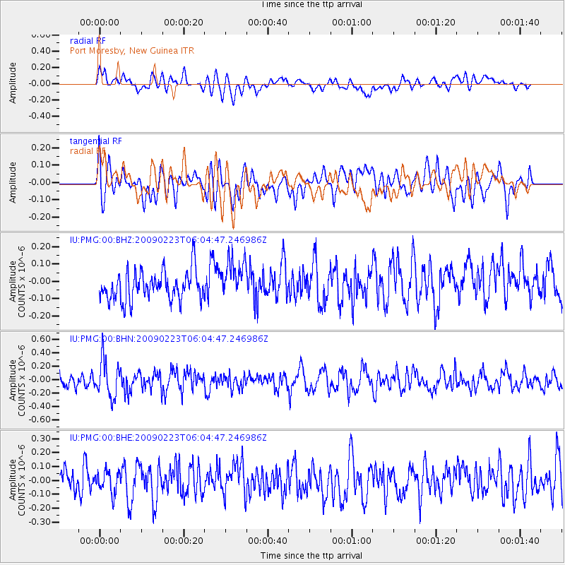
PMG Port Moresby, New Guinea - Earthquake Result Viewer
*The percent match for this event was below the threshold and hence no stack was calculated.
| Earthquake location: |
Northern Sumatra, Indonesia |
| Earthquake latitude/longitude: |
0.5/98.5 |
| Earthquake time(UTC): |
2009/02/23 (054) 05:56:31 GMT |
| Earthquake Depth: |
35 km |
| Earthquake Magnitude: |
5.8 MB, 5.1 MS, 5.4 MW, 5.4 MW |
| Earthquake Catalog/Contributor: |
WHDF/NEIC |
|
| Network: |
IU Global Seismograph Network (GSN - IRIS/USGS) |
| Station: |
PMG Port Moresby, New Guinea |
| Lat/Lon: |
9.41 S/147.15 E |
| Elevation: |
67 m |
|
| Distance: |
49.4 deg |
| Az: |
102.775 deg |
| Baz: |
278.76 deg |
| Ray Param: |
$rayparam |
*The percent match for this event was below the threshold and hence was not used in the summary stack. |
|
| Radial Match: |
48.59185 % |
| Radial Bump: |
400 |
| Transverse Match: |
46.56955 % |
| Transverse Bump: |
400 |
| SOD ConfigId: |
2658 |
| Insert Time: |
2010-03-02 15:21:07.583 +0000 |
| GWidth: |
2.5 |
| Max Bumps: |
400 |
| Tol: |
0.001 |
|
Signal To Noise
| Channel | StoN | STA | LTA |
| IU:PMG:00:BHN:20090223T06:04:47.246986Z | 3.4387815 | 2.797715E-7 | 8.135775E-8 |
| IU:PMG:00:BHE:20090223T06:04:47.246986Z | 0.84014684 | 7.912019E-8 | 9.417424E-8 |
| IU:PMG:00:BHZ:20090223T06:04:47.246986Z | 1.4162607 | 1.177922E-7 | 8.3171265E-8 |
| Arrivals |
| Ps | |
| PpPs | |
| PsPs/PpSs | |


