You are here: Home > Network List > IU - Global Seismograph Network (GSN - IRIS/USGS) Stations List
> Station PMG Port Moresby, New Guinea > Earthquake Result Viewer
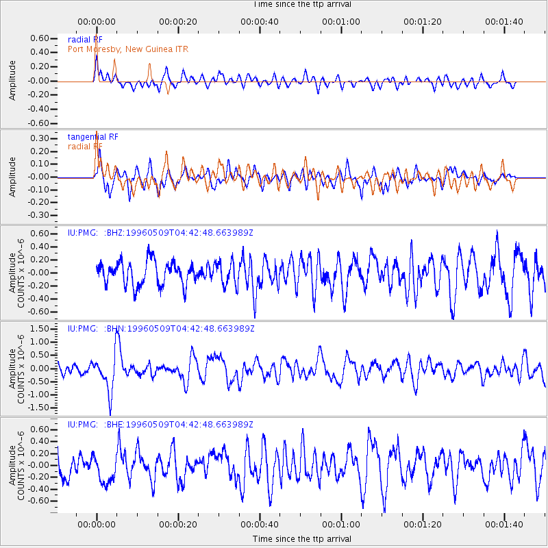
PMG Port Moresby, New Guinea - Earthquake Result Viewer
*The percent match for this event was below the threshold and hence no stack was calculated.
| Earthquake location: |
South Of Kermadec Islands |
| Earthquake latitude/longitude: |
-32.6/-179.4 |
| Earthquake time(UTC): |
1996/05/09 (130) 04:36:03 GMT |
| Earthquake Depth: |
77 km |
| Earthquake Magnitude: |
5.8 UNKNOWN, 5.0 MS, 5.4 MB |
| Earthquake Catalog/Contributor: |
WHDF/NEIC |
|
| Network: |
IU Global Seismograph Network (GSN - IRIS/USGS) |
| Station: |
PMG Port Moresby, New Guinea |
| Lat/Lon: |
9.41 S/147.15 E |
| Elevation: |
67 m |
|
| Distance: |
38.6 deg |
| Az: |
299.23 deg |
| Baz: |
131.718 deg |
| Ray Param: |
$rayparam |
*The percent match for this event was below the threshold and hence was not used in the summary stack. |
|
| Radial Match: |
62.627625 % |
| Radial Bump: |
400 |
| Transverse Match: |
65.39976 % |
| Transverse Bump: |
400 |
| SOD ConfigId: |
4480 |
| Insert Time: |
2010-03-02 15:21:40.775 +0000 |
| GWidth: |
2.5 |
| Max Bumps: |
400 |
| Tol: |
0.001 |
|
Signal To Noise
| Channel | StoN | STA | LTA |
| IU:PMG: :BHN:19960509T04:42:48.663989Z | 3.8072288 | 7.253512E-7 | 1.9051946E-7 |
| IU:PMG: :BHE:19960509T04:42:48.663989Z | 1.2190458 | 2.4952865E-7 | 2.0469179E-7 |
| IU:PMG: :BHZ:19960509T04:42:48.663989Z | 1.0259051 | 1.8269176E-7 | 1.7807862E-7 |
| Arrivals |
| Ps | |
| PpPs | |
| PsPs/PpSs | |


