You are here: Home > Network List > IU - Global Seismograph Network (GSN - IRIS/USGS) Stations List
> Station PMG Port Moresby, New Guinea > Earthquake Result Viewer
PMG Port Moresby, New Guinea - Earthquake Result Viewer
*The percent match for this event was below the threshold and hence no stack was calculated.
| Earthquake location: |
Cook Strait, New Zealand |
| Earthquake latitude/longitude: |
-41.0/174.1 |
| Earthquake time(UTC): |
1995/03/22 (081) 19:43:30 GMT |
| Earthquake Depth: |
90 km |
| Earthquake Magnitude: |
5.5 MB |
| Earthquake Catalog/Contributor: |
WHDF/NEIC |
|
| Network: |
IU Global Seismograph Network (GSN - IRIS/USGS) |
| Station: |
PMG Port Moresby, New Guinea |
| Lat/Lon: |
9.41 S/147.15 E |
| Elevation: |
67 m |
|
| Distance: |
39.5 deg |
| Az: |
315.388 deg |
| Baz: |
147.419 deg |
| Ray Param: |
$rayparam |
*The percent match for this event was below the threshold and hence was not used in the summary stack. |
|
| Radial Match: |
77.8937 % |
| Radial Bump: |
400 |
| Transverse Match: |
66.79239 % |
| Transverse Bump: |
400 |
| SOD ConfigId: |
4480 |
| Insert Time: |
2010-03-02 15:22:07.645 +0000 |
| GWidth: |
2.5 |
| Max Bumps: |
400 |
| Tol: |
0.001 |
|
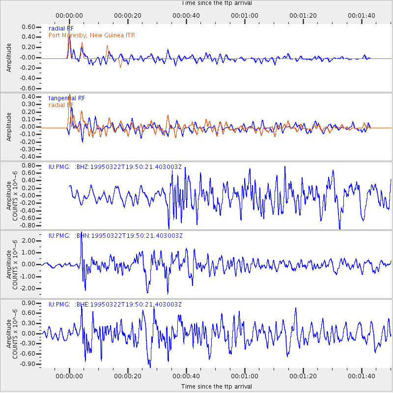
Signal To Noise
| Channel | StoN | STA | LTA |
| IU:PMG: :BHN:19950322T19:50:21.403003Z | 4.6639624 | 7.2427156E-7 | 1.5529105E-7 |
| IU:PMG: :BHE:19950322T19:50:21.403003Z | 1.8355883 | 2.440621E-7 | 1.3296125E-7 |
| IU:PMG: :BHZ:19950322T19:50:21.403003Z | 1.7633057 | 2.580973E-7 | 1.4637128E-7 |
| Arrivals |
| Ps | |
| PpPs | |
| PsPs/PpSs | |


