You are here: Home > Network List > IU - Global Seismograph Network (GSN - IRIS/USGS) Stations List
> Station PMG Port Moresby, New Guinea > Earthquake Result Viewer
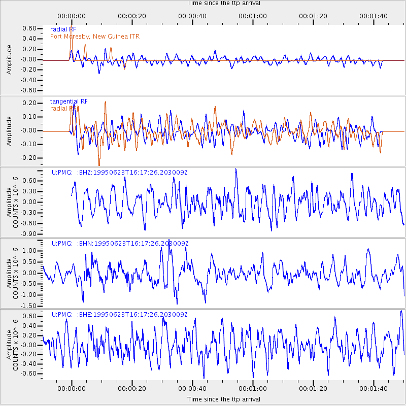
PMG Port Moresby, New Guinea - Earthquake Result Viewer
*The percent match for this event was below the threshold and hence no stack was calculated.
| Earthquake location: |
South Of Fiji Islands |
| Earthquake latitude/longitude: |
-24.6/-177.3 |
| Earthquake time(UTC): |
1995/06/23 (174) 16:10:56 GMT |
| Earthquake Depth: |
108 km |
| Earthquake Magnitude: |
5.8 UNKNOWN, 5.4 MB |
| Earthquake Catalog/Contributor: |
WHDF/NEIC |
|
| Network: |
IU Global Seismograph Network (GSN - IRIS/USGS) |
| Station: |
PMG Port Moresby, New Guinea |
| Lat/Lon: |
9.41 S/147.15 E |
| Elevation: |
67 m |
|
| Distance: |
37.1 deg |
| Az: |
287.784 deg |
| Baz: |
118.523 deg |
| Ray Param: |
$rayparam |
*The percent match for this event was below the threshold and hence was not used in the summary stack. |
|
| Radial Match: |
52.25388 % |
| Radial Bump: |
400 |
| Transverse Match: |
53.59333 % |
| Transverse Bump: |
400 |
| SOD ConfigId: |
4480 |
| Insert Time: |
2010-03-02 15:22:31.877 +0000 |
| GWidth: |
2.5 |
| Max Bumps: |
400 |
| Tol: |
0.001 |
|
Signal To Noise
| Channel | StoN | STA | LTA |
| IU:PMG: :BHN:19950623T16:17:26.203009Z | 1.8880271 | 4.7726934E-7 | 2.5278734E-7 |
| IU:PMG: :BHE:19950623T16:17:26.203009Z | 1.0927018 | 2.298919E-7 | 2.1038849E-7 |
| IU:PMG: :BHZ:19950623T16:17:26.203009Z | 0.84498465 | 2.8932746E-7 | 3.424056E-7 |
| Arrivals |
| Ps | |
| PpPs | |
| PsPs/PpSs | |


