You are here: Home > Network List > IU - Global Seismograph Network (GSN - IRIS/USGS) Stations List
> Station PMG Port Moresby, New Guinea > Earthquake Result Viewer
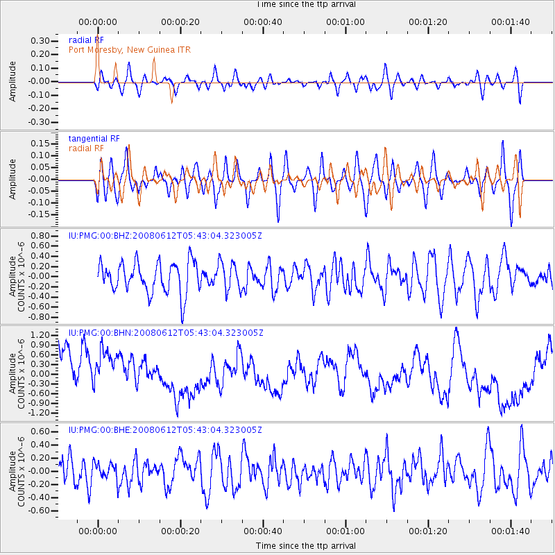
PMG Port Moresby, New Guinea - Earthquake Result Viewer
*The percent match for this event was below the threshold and hence no stack was calculated.
| Earthquake location: |
Southern East Pacific Rise |
| Earthquake latitude/longitude: |
-50.2/-114.2 |
| Earthquake time(UTC): |
2008/06/12 (164) 05:30:43 GMT |
| Earthquake Depth: |
10 km |
| Earthquake Magnitude: |
5.6 MS, 5.3 MB, 5.9 MW, 5.9 MW |
| Earthquake Catalog/Contributor: |
WHDF/NEIC |
|
| Network: |
IU Global Seismograph Network (GSN - IRIS/USGS) |
| Station: |
PMG Port Moresby, New Guinea |
| Lat/Lon: |
9.41 S/147.15 E |
| Elevation: |
67 m |
|
| Distance: |
88.4 deg |
| Az: |
257.377 deg |
| Baz: |
140.497 deg |
| Ray Param: |
$rayparam |
*The percent match for this event was below the threshold and hence was not used in the summary stack. |
|
| Radial Match: |
46.916687 % |
| Radial Bump: |
400 |
| Transverse Match: |
55.560097 % |
| Transverse Bump: |
400 |
| SOD ConfigId: |
2504 |
| Insert Time: |
2010-03-02 15:22:41.950 +0000 |
| GWidth: |
2.5 |
| Max Bumps: |
400 |
| Tol: |
0.001 |
|
Signal To Noise
| Channel | StoN | STA | LTA |
| IU:PMG:00:BHN:20080612T05:43:04.323005Z | 1.1101589 | 9.755239E-7 | 8.7872456E-7 |
| IU:PMG:00:BHE:20080612T05:43:04.323005Z | 0.6619572 | 1.2611484E-7 | 1.9051812E-7 |
| IU:PMG:00:BHZ:20080612T05:43:04.323005Z | 0.92933315 | 2.815291E-7 | 3.0293668E-7 |
| Arrivals |
| Ps | |
| PpPs | |
| PsPs/PpSs | |


