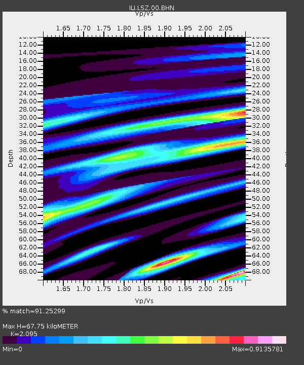
LSZ Lusaka, Zambia - Earthquake Result Viewer
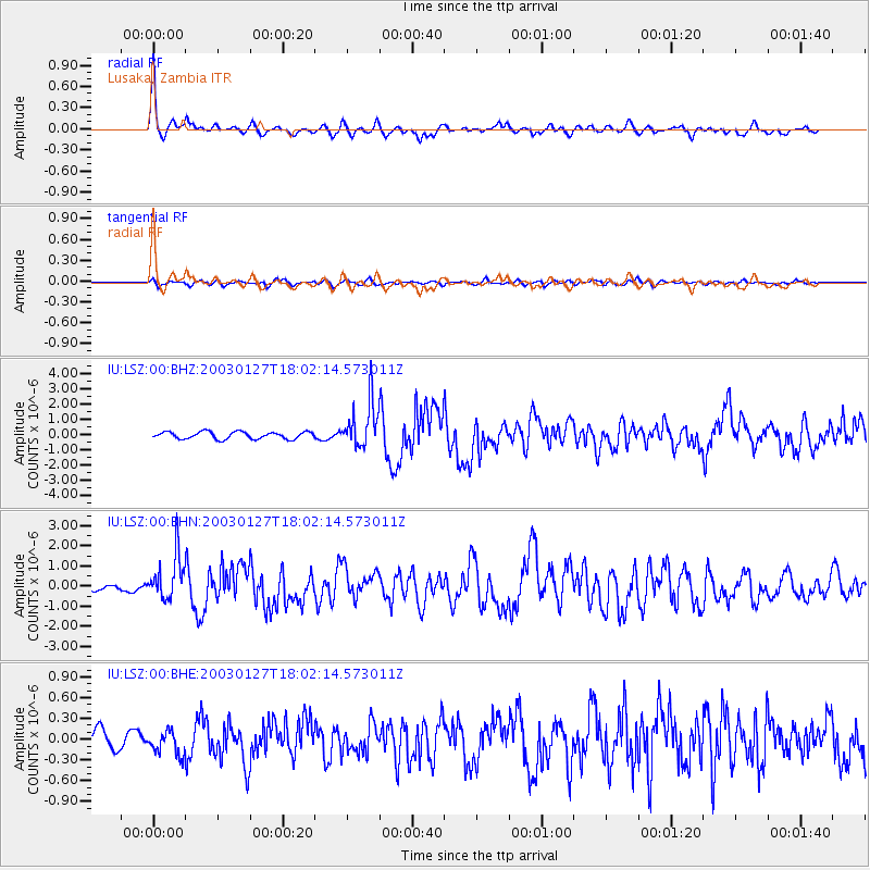
Earthquake location: Prince Edward Islands Region
Earthquake latitude/longitude: -46.0/35.1
Earthquake time(UTC): 2003/01/27 (027) 17:56:25 GMT
Earthquake Depth: 10 km
Earthquake Magnitude: 5.6 MB, 6.3 MS, 6.5 MW, 6.4 MW
Earthquake Catalog/Contributor: WHDF/NEIC
Network: IU Global Seismograph Network (GSN - IRIS/USGS)
Station: LSZ Lusaka, Zambia
Lat/Lon: 15.28 S/28.19 E
Elevation: 1184 m
Distance: 31.2 deg
Az: 347.131 deg
Baz: 170.751 deg
Ray Param: 0.07912816
Estimated Moho Depth: 67.75 km
Estimated Crust Vp/Vs: 2.10
Assumed Crust Vp: 6.642 km/s
Estimated Crust Vs: 3.17 km/s
Estimated Crust Poisson's Ratio: 0.35
Radial Match: 91.25299 %
Radial Bump: 331
Transverse Match: 73.843445 %
Transverse Bump: 400
SOD ConfigId: 4714
Insert Time: 2010-03-02 15:23:07.342 +0000
GWidth: 2.5
Max Bumps: 400
Tol: 0.001

Signal To Noise

ChannelStoNSTALTA
IU:LSZ:00:BHN:20030127T18:02:14.573011Z9.9259991.1057102E-61.1139536E-7
IU:LSZ:00:BHE:20030127T18:02:14.573011Z1.14948741.6616616E-71.4455675E-7
IU:LSZ:00:BHZ:20030127T18:02:14.573011Z6.3455161.4729353E-62.3212222E-7
Arrivals
Ps12 SECOND
PpPs29 SECOND
PsPs/PpSs41 SECOND