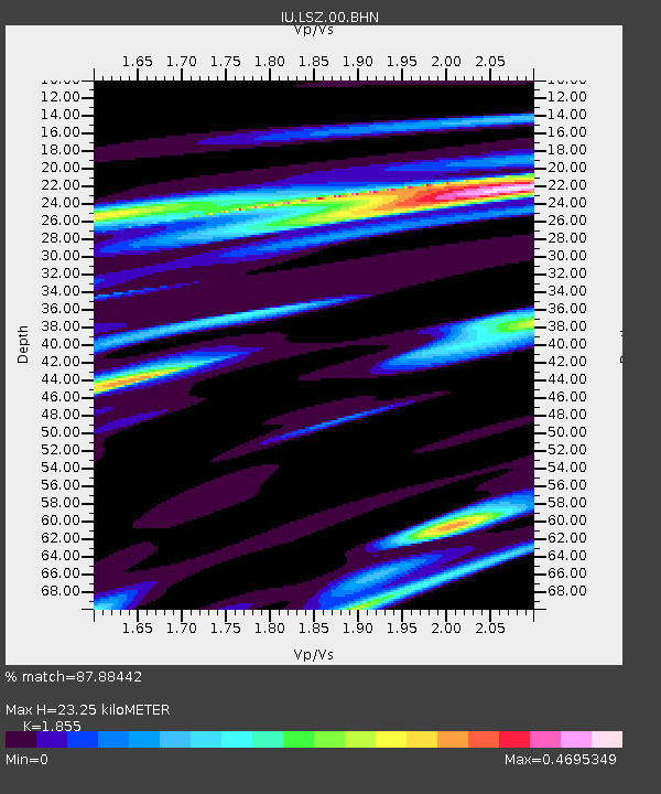
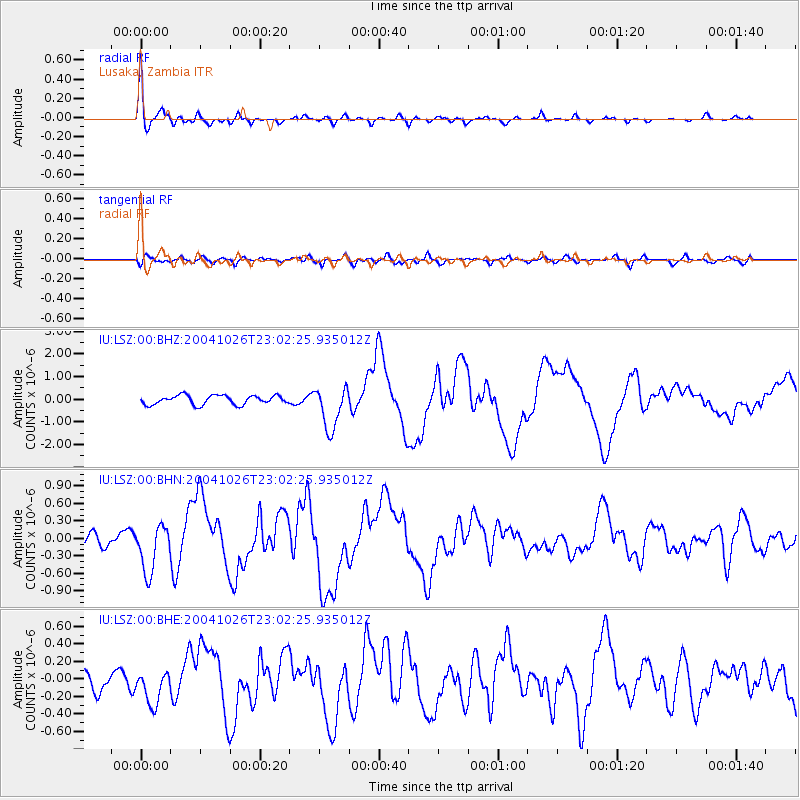
LSZ Lusaka, Zambia - Earthquake Result Viewer

Earthquake location: South Sandwich Islands Region
Earthquake latitude/longitude: -57.1/-24.7
Earthquake time(UTC): 2004/10/26 (300) 22:53:07 GMT
Earthquake Depth: 10 km
Earthquake Magnitude: 5.6 MB, 6.3 MS, 6.4 MW, 6.2 MW
Earthquake Catalog/Contributor: WHDF/NEIC
Network: IU Global Seismograph Network (GSN - IRIS/USGS)
Station: LSZ Lusaka, Zambia
Lat/Lon: 15.28 S/28.19 E
Elevation: 1184 m
Distance: 57.5 deg
Az: 65.848 deg
Baz: 211.09 deg
Ray Param: 0.06346144
Estimated Moho Depth: 23.25 km
Estimated Crust Vp/Vs: 1.86
Assumed Crust Vp: 6.642 km/s
Estimated Crust Vs: 3.581 km/s
Estimated Crust Poisson's Ratio: 0.30
Radial Match: 87.88442 %
Radial Bump: 400
Transverse Match: 59.82803 %
Transverse Bump: 400
SOD ConfigId: 2459
Insert Time: 2010-03-02 15:23:55.535 +0000
GWidth: 2.5
Max Bumps: 400
Tol: 0.001

Signal To Noise

ChannelStoNSTALTA
IU:LSZ:00:BHN:20041026T23:02:25.935012Z2.17627174.0779236E-71.8738119E-7
IU:LSZ:00:BHE:20041026T23:02:25.935012Z1.40960281.9403844E-71.376547E-7
IU:LSZ:00:BHZ:20041026T23:02:25.935012Z4.66223349.415509E-72.0195276E-7
Arrivals
Ps3.1 SECOND
PpPs9.5 SECOND
PsPs/PpSs13 SECOND